Miami & Erie Canal and Cincinnati Subway
Photos from Downtown Cincinnati to Troy
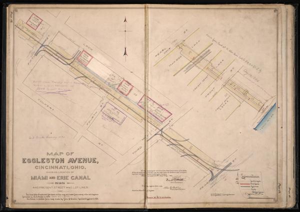
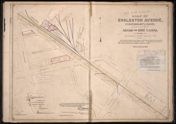
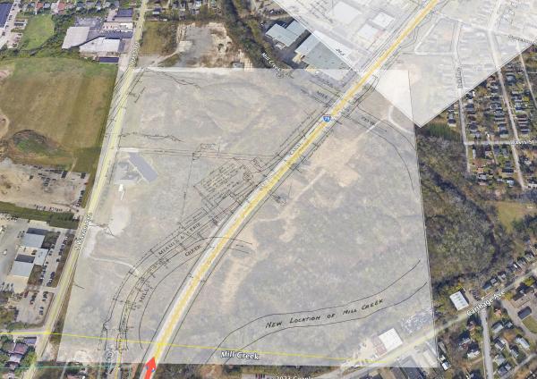
Historical plat map of the Miami & Erie Canal under Eggleston Avenue
Historical plat map of the Miami & Erie Canal under Eggleston Avenue
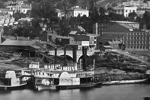
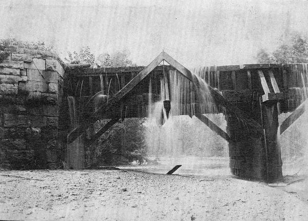
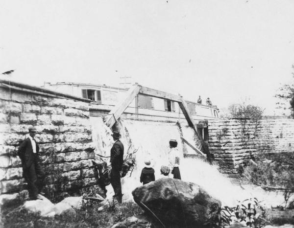
Historic photo of the Cincinnati riverfront where the Miami & Erie Canal entered the Ohio River
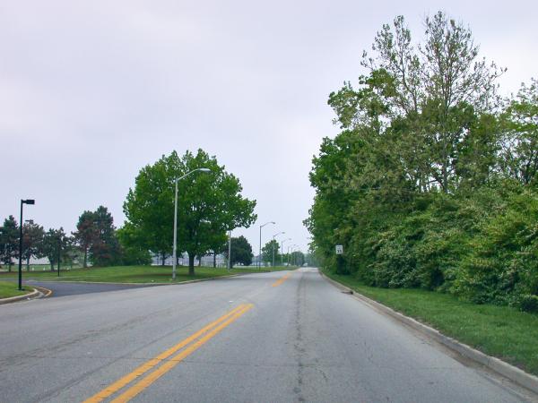
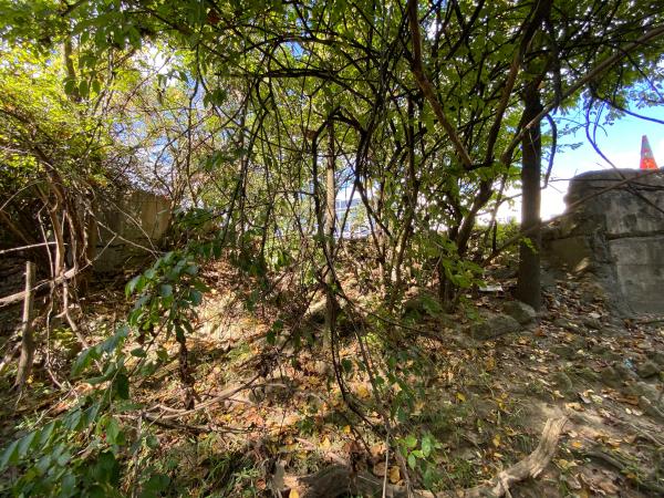
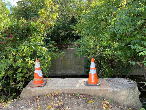
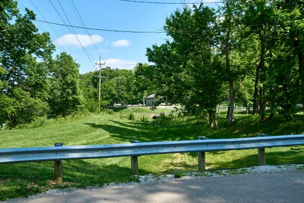
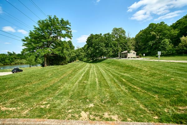
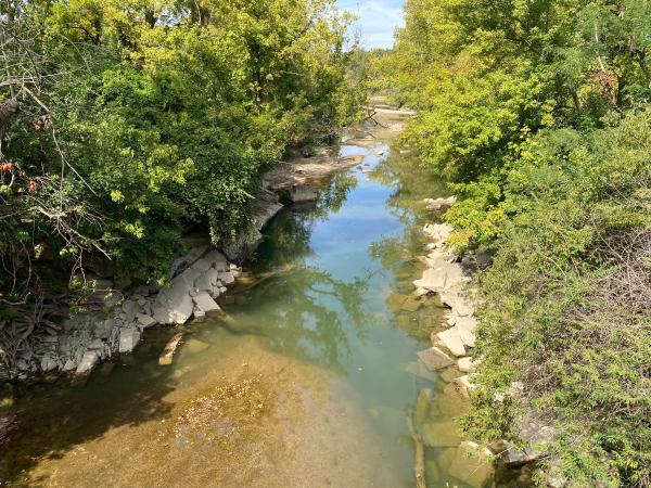
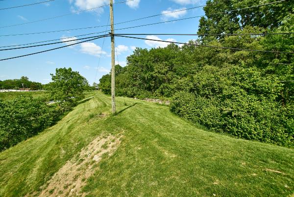
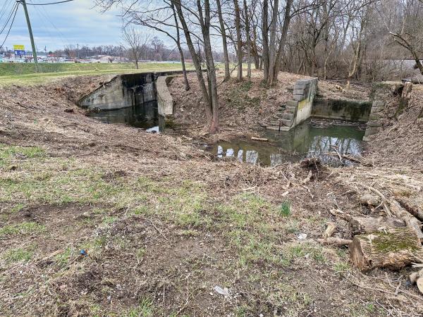
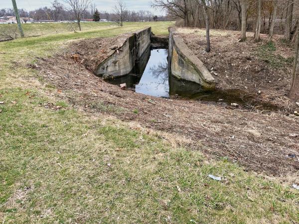
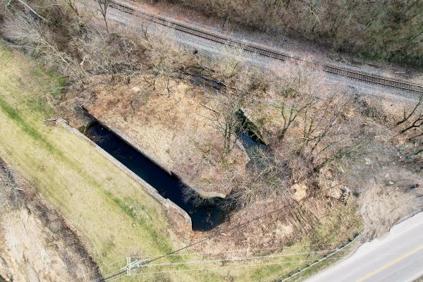
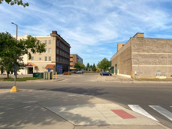
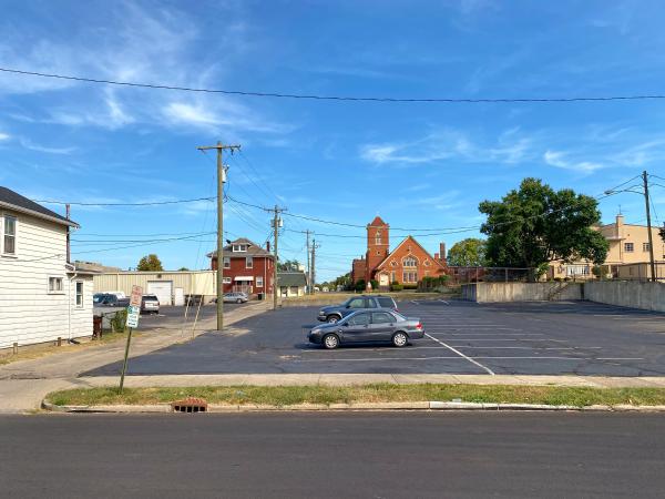
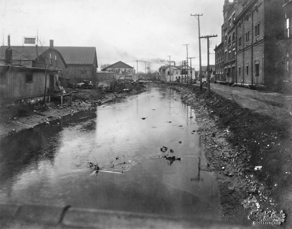
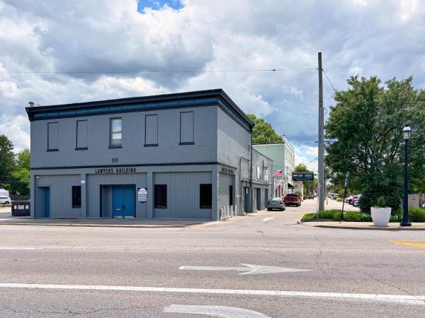
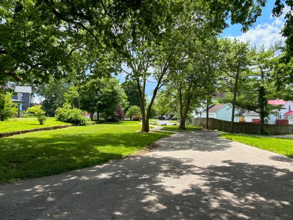
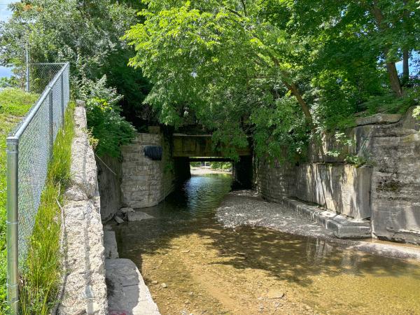
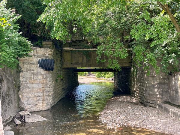
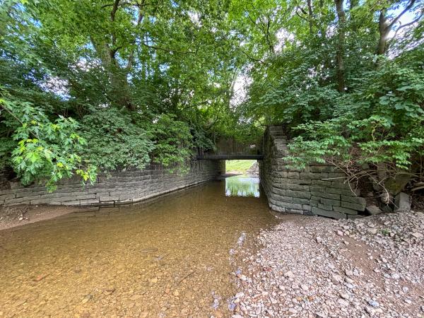
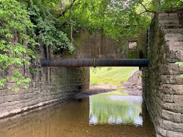
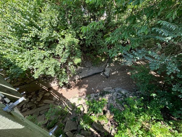
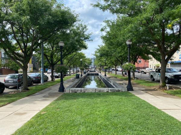
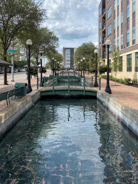
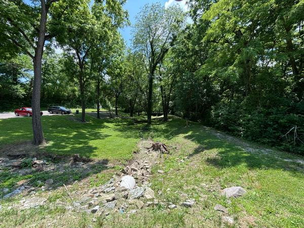
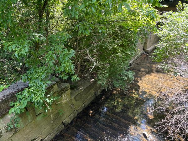
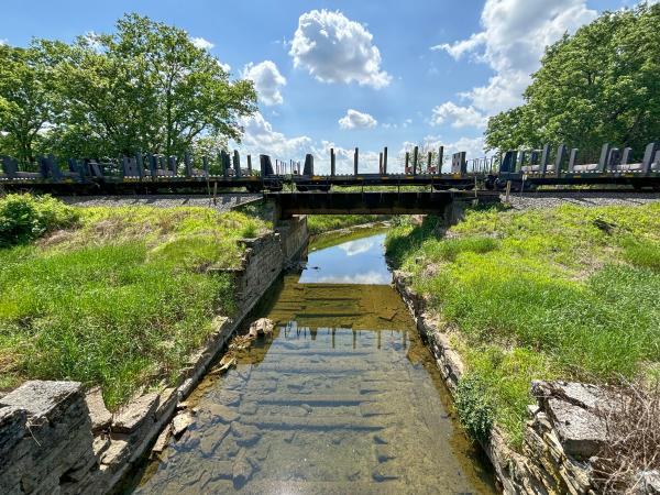
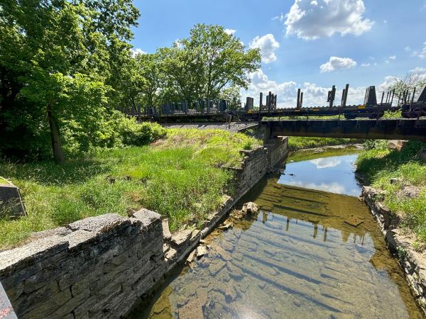
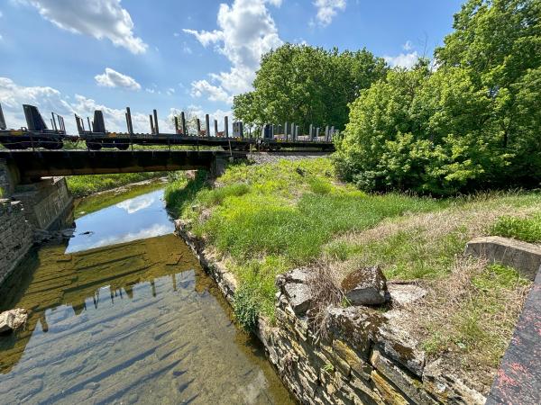
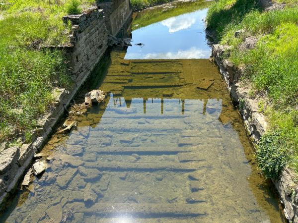
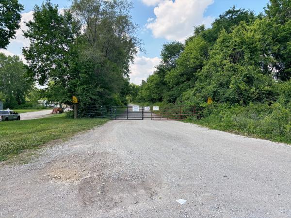
Location of the Miami & Erie Canal's discharge into the Ohio River
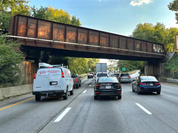
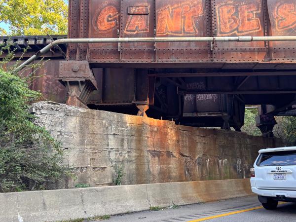
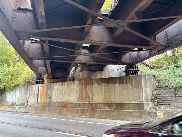
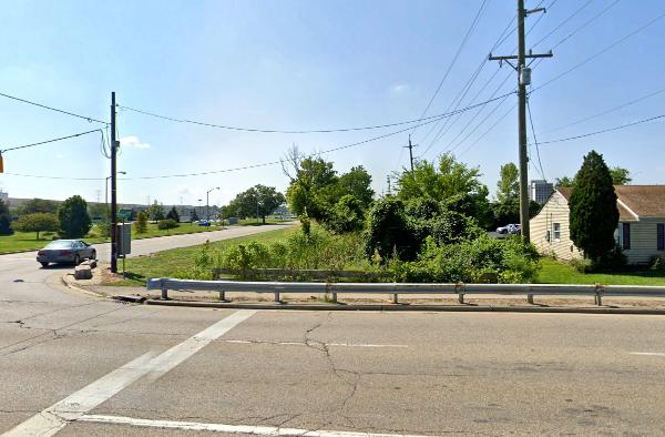
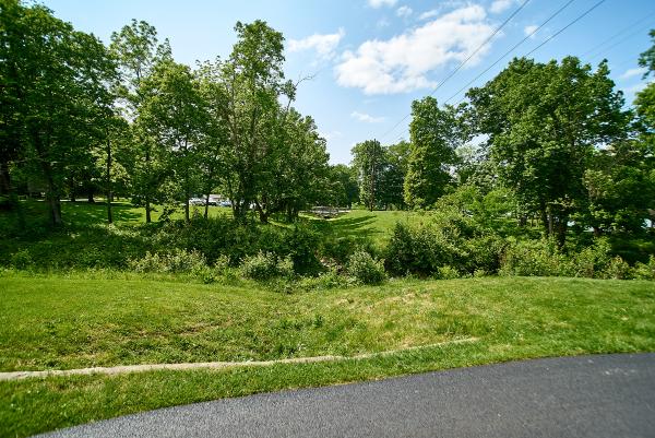
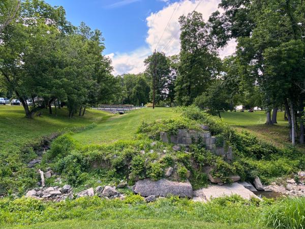
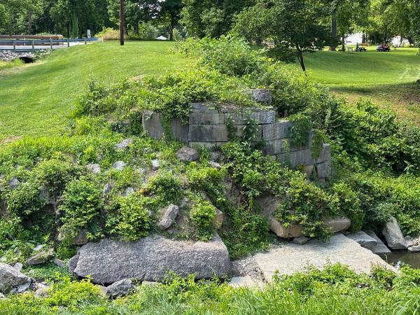
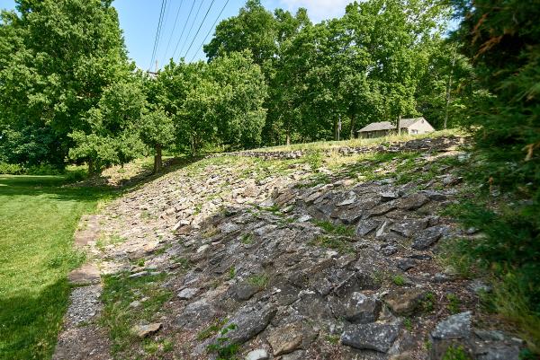
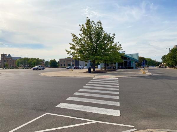
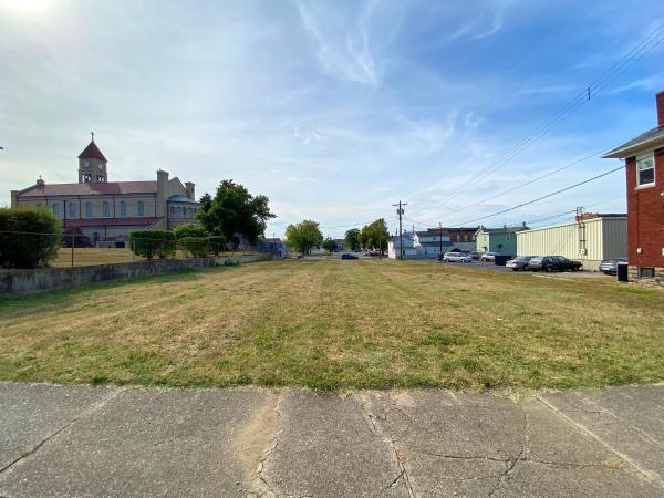
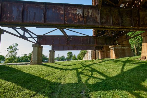
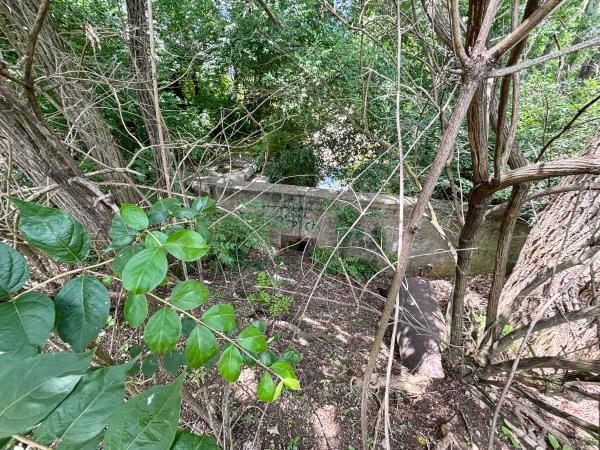
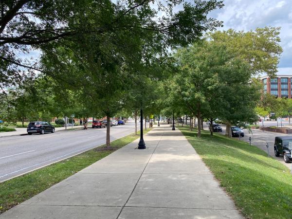
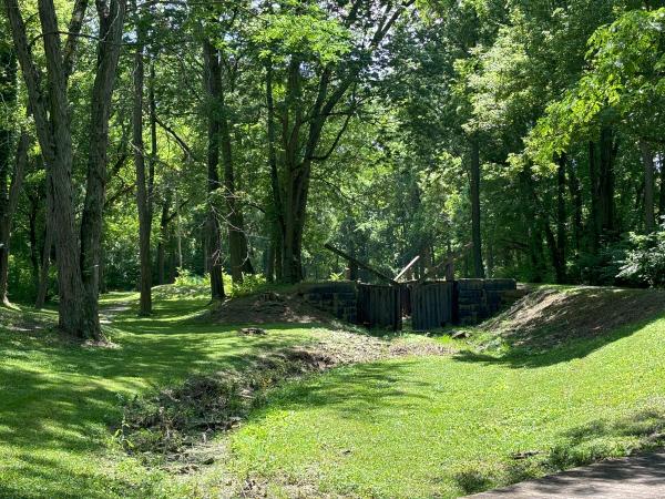
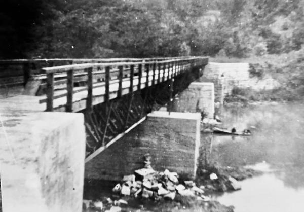
Location of the Miami & Erie Canal and the Front Street bridge in Sawyer Point,
1853 painting of Cincinnati and the Miami & Erie Canal as seen from atop Mt. Adams
Historical painting of Cincinnati and the Miami & Erie Canal in 1841
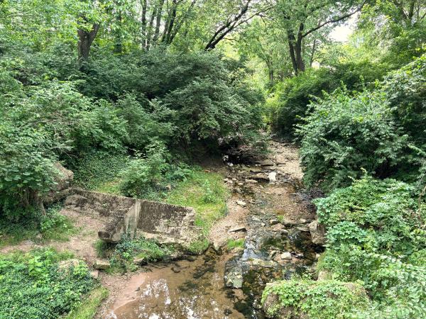
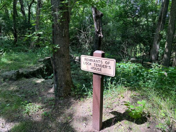
Historic photo of 5th and Lock Streets at the base of the Mt. Adams Incline
Historic photo of the Miami & Erie Canal mill race next to Eggleston Avenue from the previous photo
Historic photo of the Miami & Erie Canal mill race next to Eggleston Avenue from the previous photo
Historic photo of the Miami & Erie Canal Lockport basin at Cheapside Avenue after draining in 1919
Historic photo of the Miami & Erie Canal Lockport basin at Cheapside Avenue sometime between 1906 and 1919
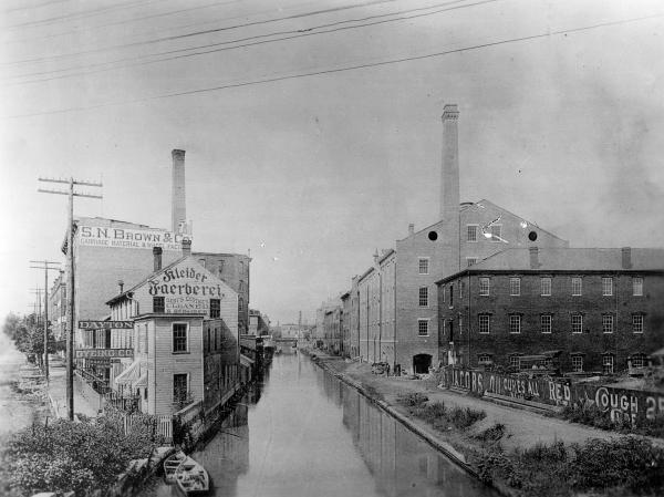
Historic photo of the Miami & Erie Canal between Main and Sycamore
Historic photo of construction of the Hamilton County Courthouse and the Miami & Erie Canal
Historic photo of construction of the Hamilton County Courthouse and the Miami & Erie Canal
Historic photo of the Miami & Erie Canal freight depot between Main and Walnut
Historic photo of the Miami & Erie Canal freight depot between Main and Walnut
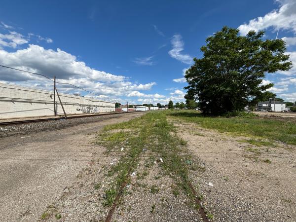
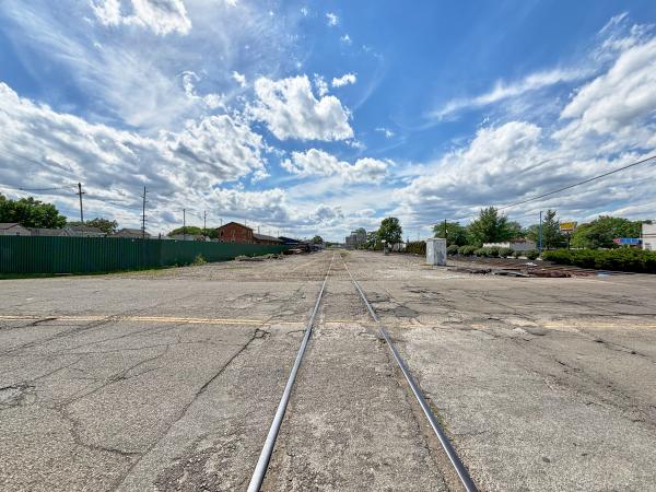
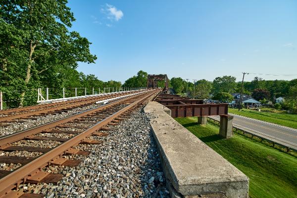
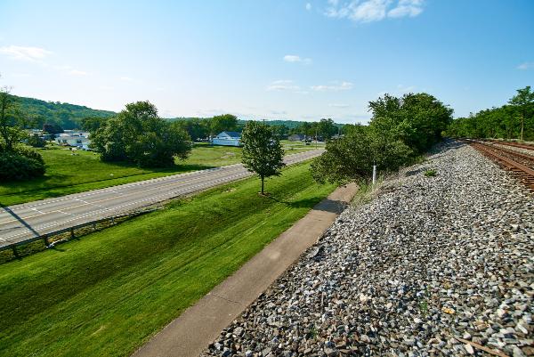
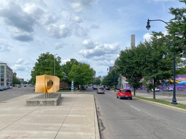
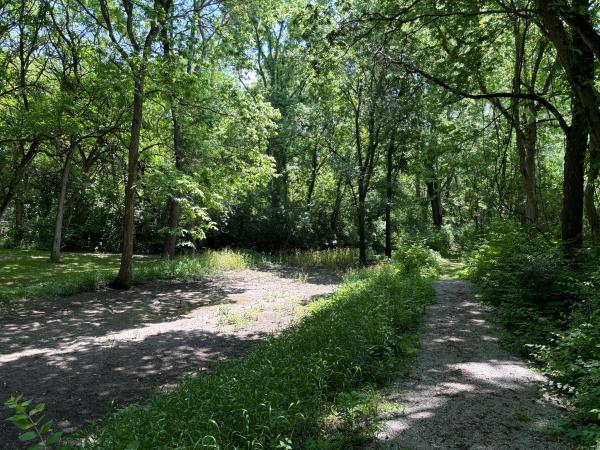
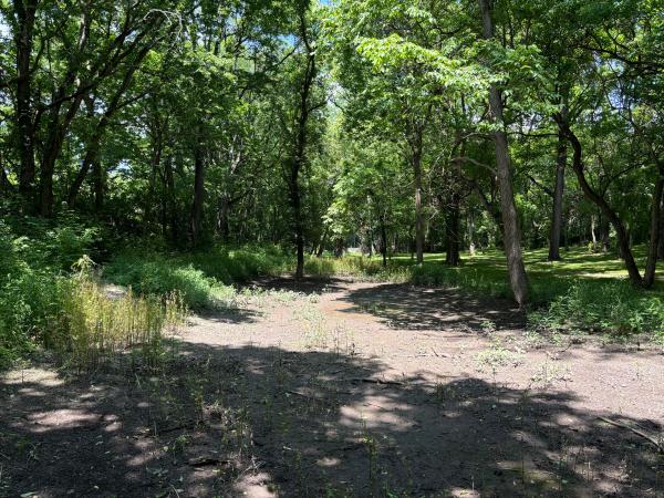
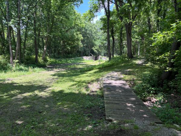
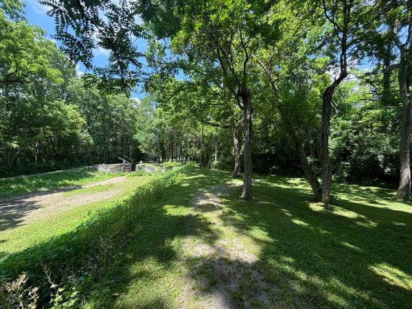
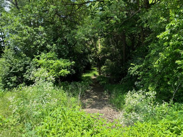
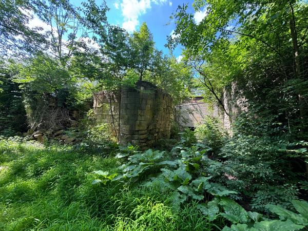
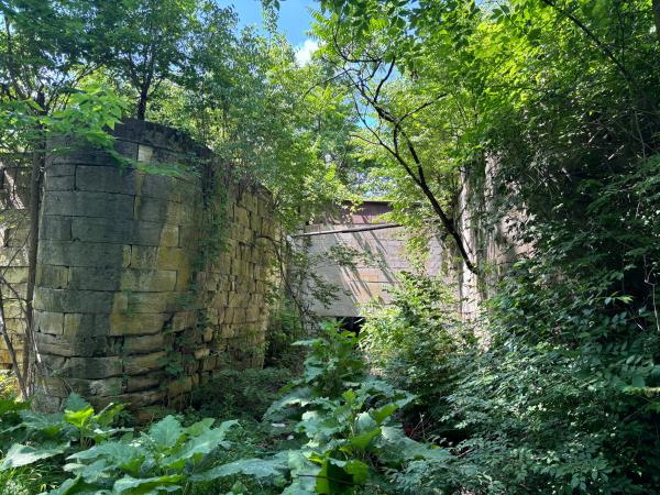
Photo of the Walnut Street stub and wye
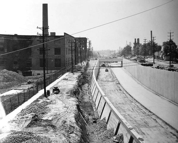
Historic photo of the Miami & Erie Canal, prior to construction of the subway
Historic photo of excavation for the subway in the Miami & Erie Canal at Vine Street
Historic photo of downtown subway construction
Historic photo of the Miami & Erie Canal and excavation for the subway on April 21, 1920
Photo of the east end of the subway's Race Street station under Vine Street
The east end of the subway's Race Street station between Race and Vine
The west end of the subway's Race Street station between Race and Elm
The subway's Race Street station stairs to Race Street
The Race Street station concourse, which was intended to provide passageways to adjacent buildings
The west end of the subway's Race Street station between Plum and Elm
Historic photo of downtown subway construction at the Plum Street bend
Historic woodcut showing the Miami & Erie Canal at the Plum Street bend
Historic photo of the Plum Street bend of the Miami & Erie Canal
Historic photo of the Lady Hamilton boat of the Lake-Erie & Miami Packet Company at the Plum Street bend of the Miami & Erie Canal
Historic photo of the Miami & Erie Canal and the City Hospital at 12th Street in 1897
Historic photo of the Miami & Erie Canal from the 12th Street bridge
Historic photo of subway construction from the 12th Street bridge
Historic photo of construction of the Liberty Street subway station
The subway's Liberty Street station
The subway's Liberty Street station
The subway's Liberty Street station
The subway's Liberty Street station stairs to Liberty Street
Historic photo of the Miami & Erie Canal north of Liberty Street after draining
Historic photo of subway construction
Historic photo of the Mohawk Place lift bridge over the Miami & Erie Canal after draining and preparation for demolition
The subway's Linn Street station
The subway's Linn Street station, looking east along the northbound/westbound platform
The subway's Brighton station
The subway's Brighton station
The subway's Brighton station
Central Parkway railing and subway vents along Colerain Avenue
Close up of the subway vents along Colerain Avenue
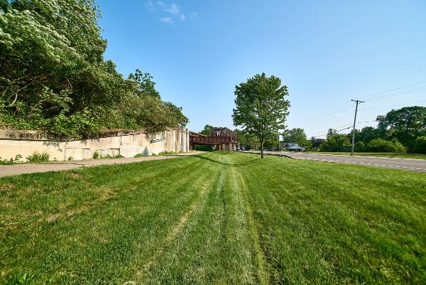
Cincinnati subway portals near Addison Street north of the Western Hills Viaduct
Historic photo of the Miami & Erie Canal at Marshall Avenue in Camp Washington
The subway's Hopple Street tunnel south portals from Central Parkway
The subway's Hopple Street tunnel south portals
The subway's Hopple Street tunnel northbound tube
The subway's Hopple Street tunnel northbound tube
The subway's Hopple Street tunnel northbound tube
Historic photo of the subway right-of-way in Camp Washington
Historic aerial of the McMicken-Main route loop at McMicken and Dixmyth (now Martin Luther King Drive) in Camp Washington
Historic aerial of Camp Washington showing the subway overpass at Bates Avenue in 1932
Historic photo of the Miami & Erie Canal along Colerain Avenue near Brashears Street and what is today Cincinnati State College
Historic photo of the blocked off Miami & Erie Canal at Ludlow Avenue
Historic photo of the Ludlow Avenue rapid transit station
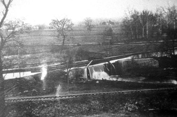
Historic postcard of the Miami & Erie Canal spillway opposite Spring Grove Avenue
Another historic postcard of the Miami & Erie Canal spillway opposite Spring Grove Avenue
Historic photo of the Miami & Erie Canal at Clifton Avenue in 1912
Historic photo of the Clifton Avenue rapid transit station in 1929
Historic photo of the Clifton Avenue rapid transit station before construction of I-75
Historic photo of the Clifton Avenue rapid transit station during construction of I-75
Historic photo of a wooden aqueduct over Mitchell Avenue on the Miami & Erie Canal
Historic photo of grading for the subway at Mitchell Avenue
Close-up view of the steel aqueduct for the Miami & Erie Canal from the previous photo
Historic photo of the subway overpass at Mitchell Avenue during the 1937 flood
Historic aerial of I-75 construction at Mitchell Avenue
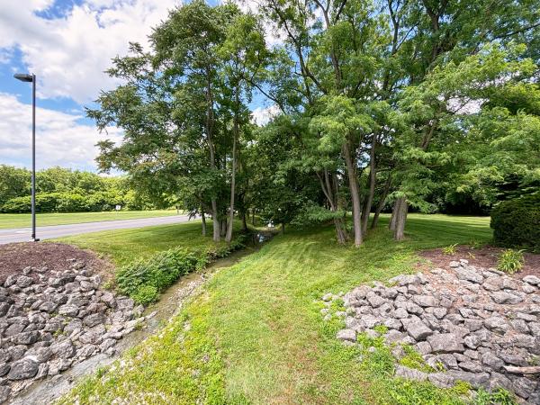
Subway and Miami & Erie Canal right-of-way in St. Bernard's Ludlow Park
Subway and Miami & Erie Canal right-of-way in St. Bernard's Ludlow Park
Subway and Miami & Erie Canal right-of-way on the Phillips Avenue entrance to St. Bernard's Ludlow Park
Subway and Miami & Erie Canal right-of-way on the Phillips Avenue entrance to St. Bernard's Ludlow Park
Subway and Miami & Erie Canal right-of-way at the end of Andalus Court in St. Bernard
A more recent view of the Subway and Miami & Erie Canal right-of-way at the end of Andalus Court in St. Bernard
Subway and Miami & Erie Canal right-of-way at the end of Andalus Court in St. Bernard
Subway and Miami & Erie Canal right-of-way between Wiedemann's Brewery and Andalus Court in St. Bernard
Subway and Miami & Erie Canal right-of-way behind Wiedemann's Brewery in St. Bernard
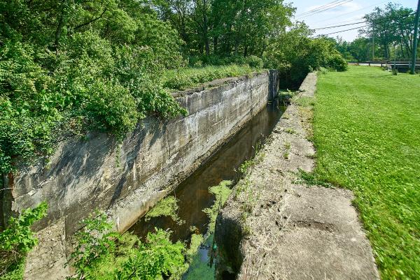
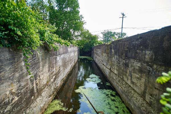
Historic photo of the Miami & Erie Canal in St. Bernard, probably taken from Vine Street
Historic photo of the Miami & Erie Canal at Vine Street in St. Bernard on July 9, 1924
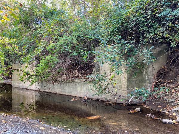
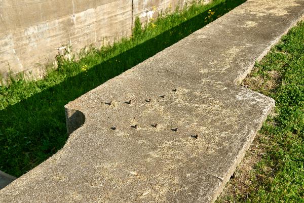
A recent view of the concrete wall from the previous historic photos
Historic photo of Vine Street in St. Bernard at Washington Avenue
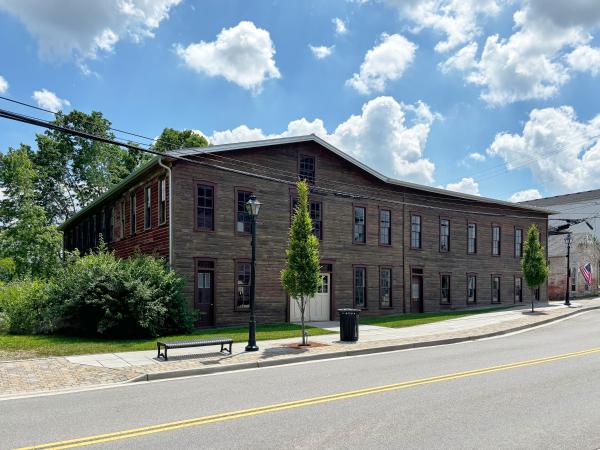
Miami & Erie Canal historical plaque at the St. Bernard municipal building
Miami & Erie Canal historical plaque at the St. Bernard municipal building
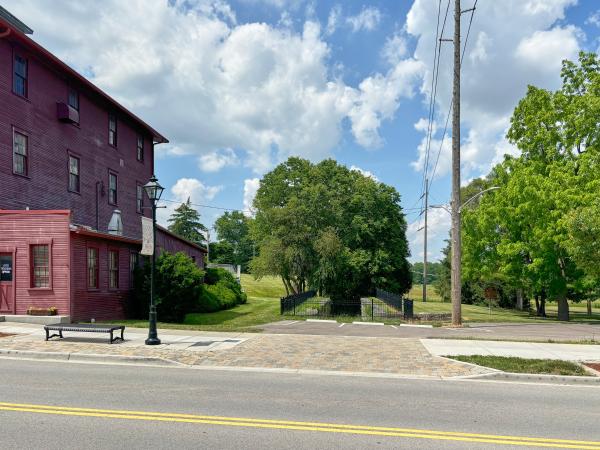
Location of the Miami & Erie Canal in front of the St. Bernard municipal building
Historic photo of Vine Street in St. Bernard at Washington Avenue
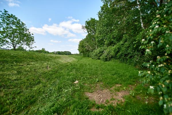
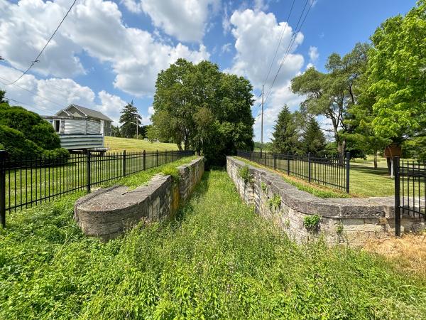
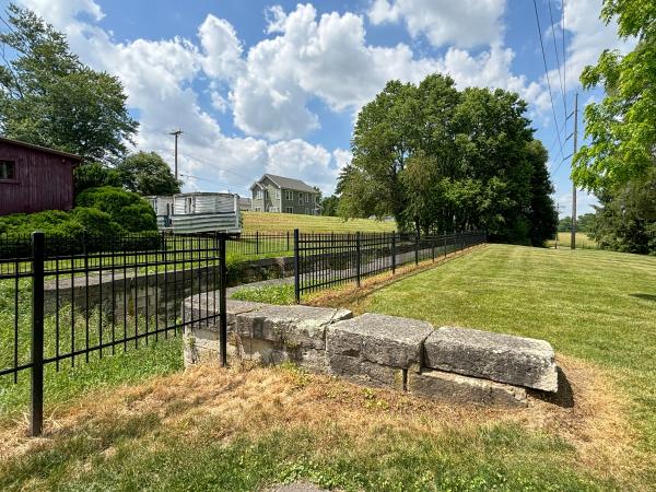
Subway and Miami & Erie Canal right-of-way through St. Bernard
Historic photo of the Miami & Erie Canal at Ross Avenue in St. Bernard on July 9, 1924
Current view of the Miami & Erie Canal and subway right-of-way at Ross Avenue in St. Bernard
Historic photo of the Miami & Erie Canal north of Ross Avenue in St. Bernard on July 8, 1924
Historic photo of the Miami & Erie Canal north of Ross Avenue in St. Bernard on July 8, 1924
Subway and Miami & Erie Canal right-of-way at City Park Drive in St. Bernard
Historic photo of the B&O Midland crossing the Miami & Erie Canal near St. Bernard in 1924
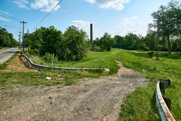
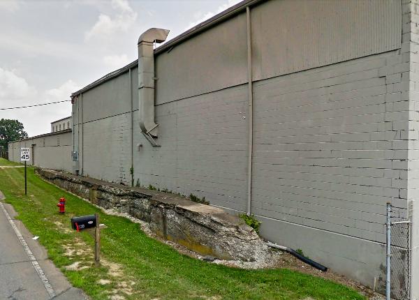
Duke Energy substation next to the Miami & Erie Canal right-of-way on Spruce Street in Elmwood Place
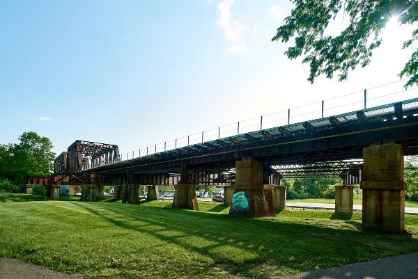
Former Big Four Railroad bridge over the Miami & Erie Canal
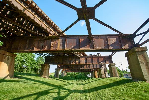
Detail of the bridge from the previous photo
Another detail of the bridge from the previous two photos
Map overlay showing how the Miami & Erie Canal diverged from I-75 south of Lockland
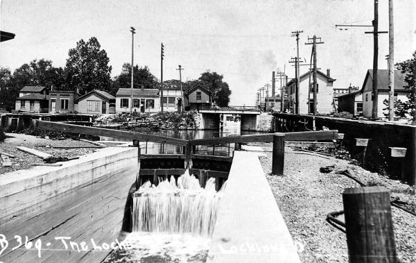
Historic photo of the Miami & Erie Canal in Lockland
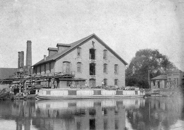
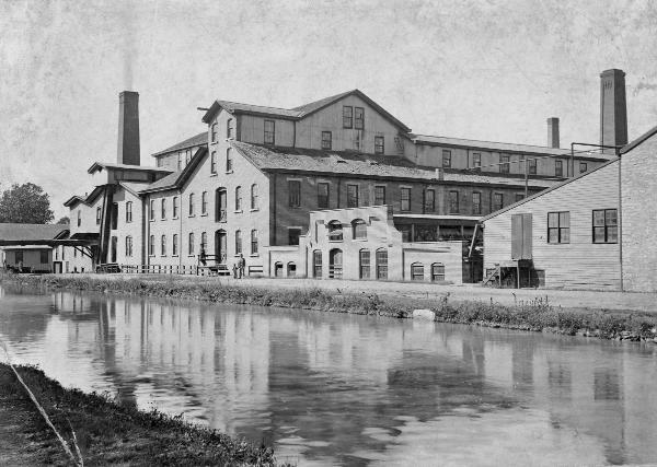
Historic photo of the Friend & Fox Paper Company in Lockland next to the Miami & Erie Canal
Historic photo of the Friend & Fox Paper Company in Lockland next to the Miami & Erie Canal in approximately 1880
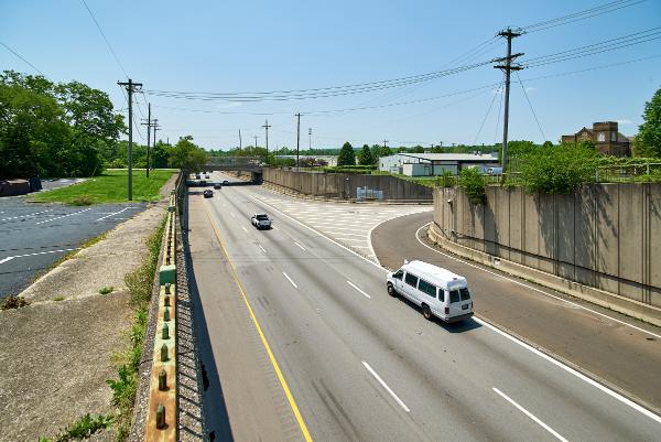
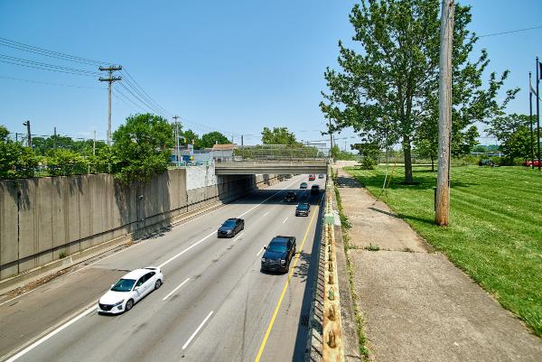
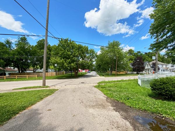
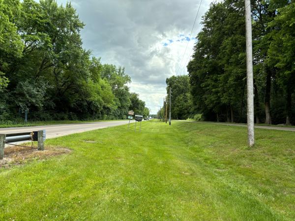
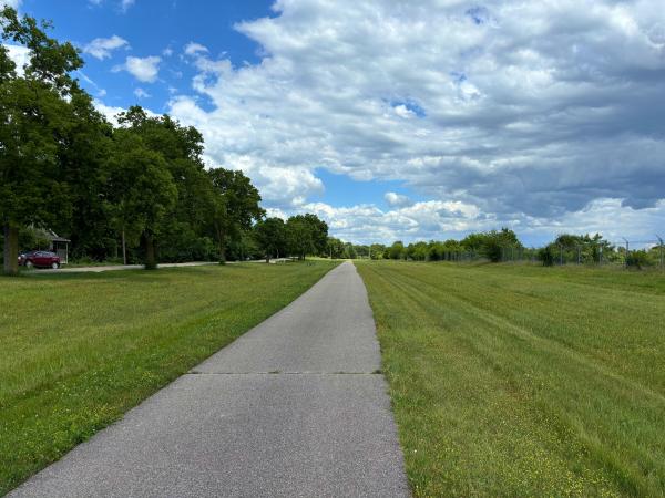
Location of the Miami & Erie Canal, now southbound I-75 in Lockland
Location of the Miami & Erie Canal, now southbound I-75 in Lockland
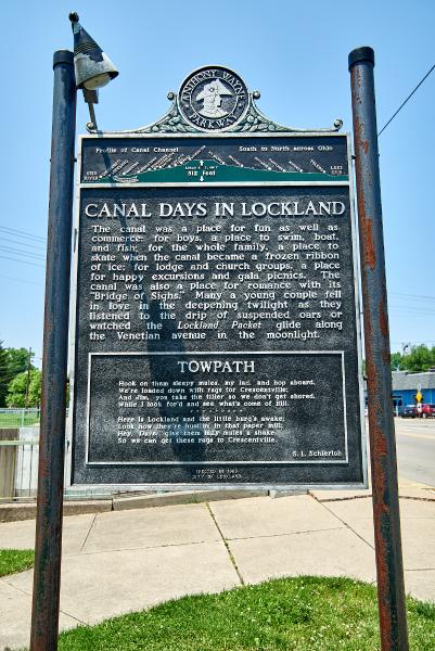
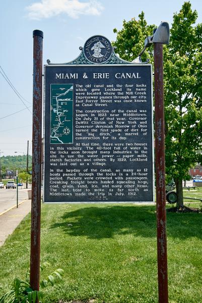
Miami & Erie Canal historical plaque at Lockland's Veterans Memorial Park
Miami & Erie Canal historical plaque at Lockland's Veterans Memorial Park
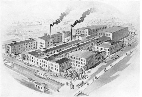
The Stearns & Foster general offices at Wyoming and Williams in Lockland
Historic drawing of the Stearns & Foster factory in Lockland and the Miami & Erie Canal at Wyoming Avenue
Historic photo of construction of the Wright-Lockland Highway next to Stearns and Foster at the location of the Miami & Erie Canal in 1943
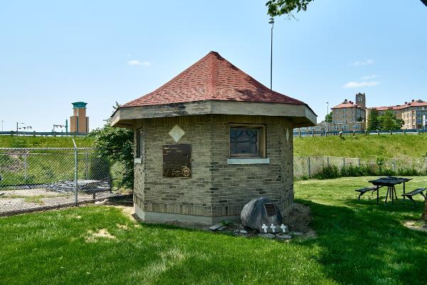
Water pump house near the Miami & Erie Canal in Evendale near the I-75 Glendadle-Milford Road exit
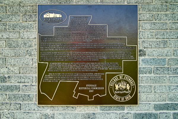
Miami & Erie Canal historical plaque on the Evendale pump house
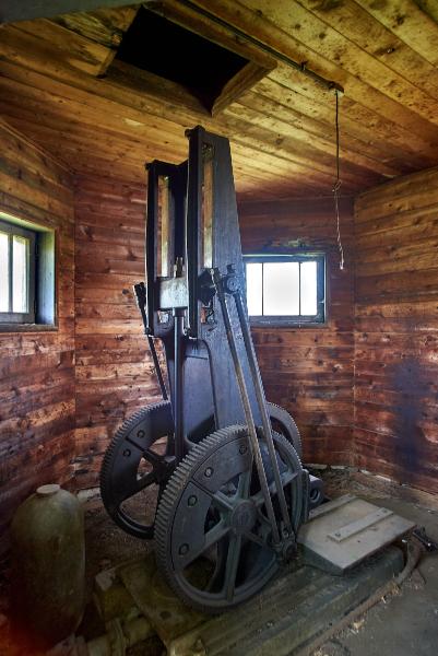
The reciprocating pump inside the Evendale pump house
The first section of intact Miami & Erie Canal along Evendale Drive in Evendale
Another intact section of the Miami & Erie Canal along Evendale Drive in Evendale
The Miami & Erie Canal along Evendale Drive in Evendale
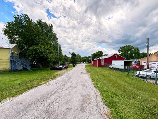
Canal Road in Sharonville
Canal Road in Sharonville
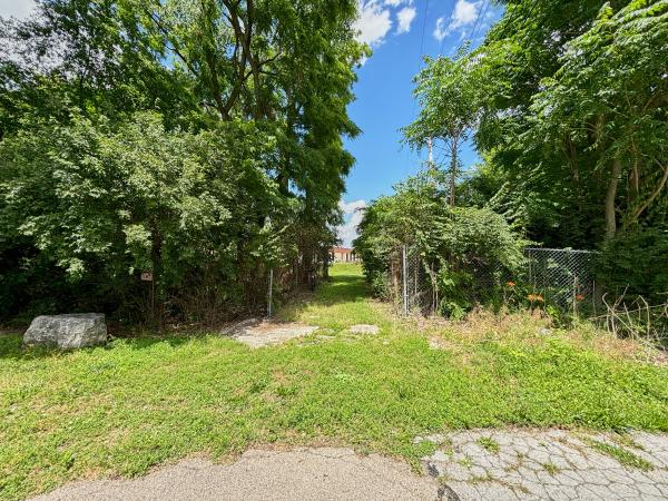
Remnants of the Miami & Erie Canal at Kemper Road and Canal Road in Sharonville
Remnants of the Miami & Erie Canal at Kemper Road and Canal Road in Sharonville
Remnants of the Miami & Erie Canal Sharonville Aqueduct near the I-75 & I-275 interchange and CDC Dubois Chemicals
Remnants of the Miami & Erie Canal Sharonville Aqueduct near the I-75 & I-275 interchange and CDC Dubois Chemicals
Remnants of the Miami & Erie Canal Sharonville Aqueduct near the I-75 & I-275 interchange and CDC Dubois Chemicals
Remnants of the Miami & Erie Canal Sharonville Aqueduct near the I-75 & I-275 interchange and CDC Dubois Chemicals
Remnants of the Miami & Erie Canal near the I-75 & I-275 interchange and CDC Dubois Chemicals
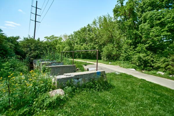
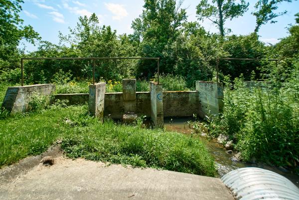
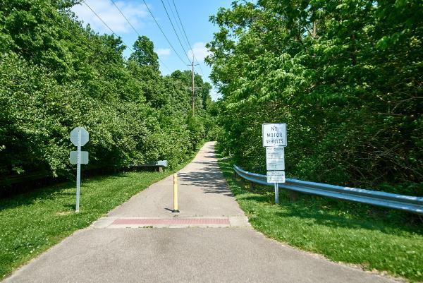
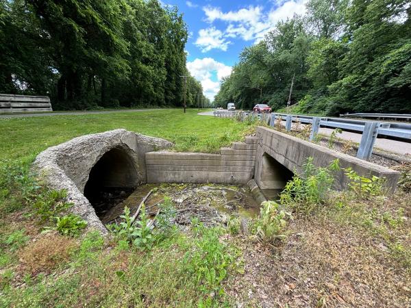
Miami & Erie Canal overflow spillway in West Chester
Miami & Erie Canal overflow spillway in West Chester
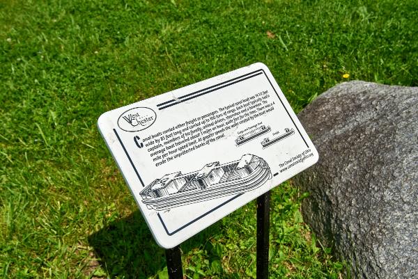
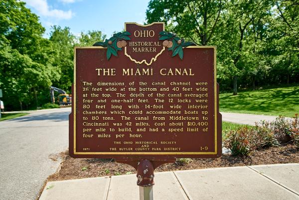
Historical marker along the Miami & Erie Canal bike path
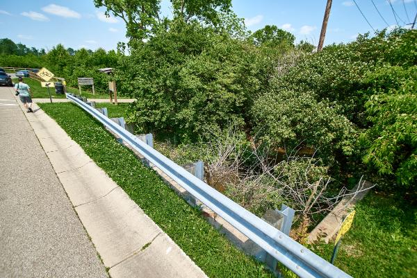
Remnants of the Miami & Erie Canal Firebird Drive and the Ellis Lake Wetlands in Fairfield/West Chester
Location of the Miami & Erie Canal Hamilton Basin at East Street
Location of the Miami & Erie Canal Hamilton Basin at East Street
Typical view of the Ford Canal Hydraulic in Hamilton
Typical view of the Miami & Erie Canal along Canal Road north of Hamilton
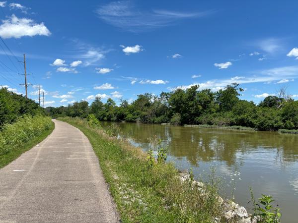
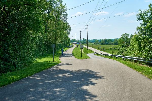
Miami & Erie Canal towpath trail between Hamilton and Rentschler Forest
Miami & Erie Canal towpath trail between Hamilton and Rentschler Forest
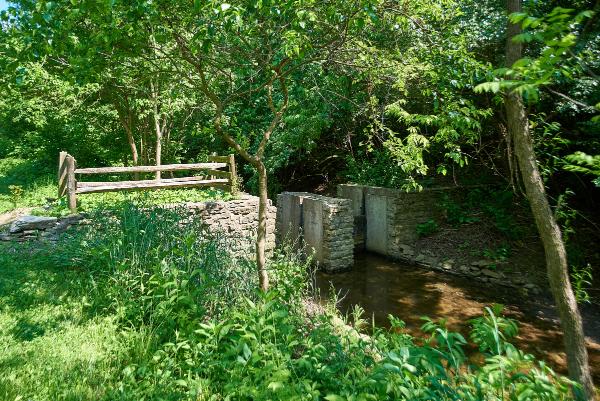
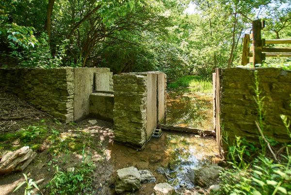
Miami & Erie Canal water diversion dam between Hamilton and Rentschler Forest
Miami & Erie Canal water diversion dam between Hamilton and Rentschler Forest
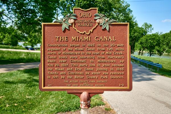
Miami & Erie Canal historical plaque in Rentschler Forest MetroPark
Miami & Erie Canal historical plaque in Rentschler Forest MetroPark
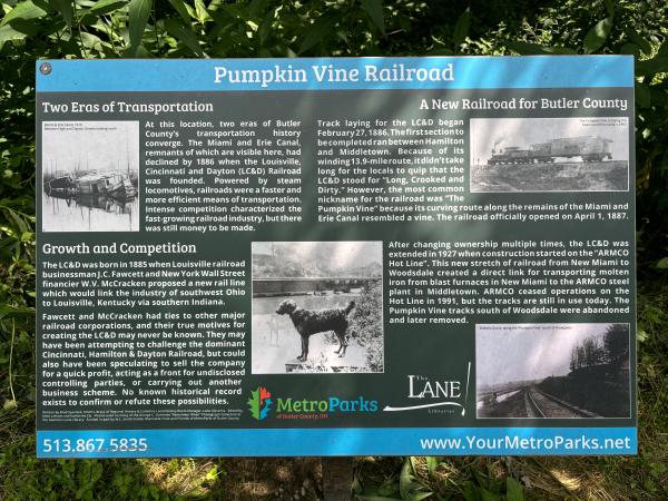
Historical information on the Miami & Erie Canal and the Louisville, Cincinnati & Dayton Railroad which became the CH&D East Middletown Branch
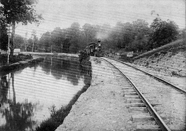
Historic photo of the Louisville, Cincinnati & Dayton Railroad which became the CH&D East Middletown Branch
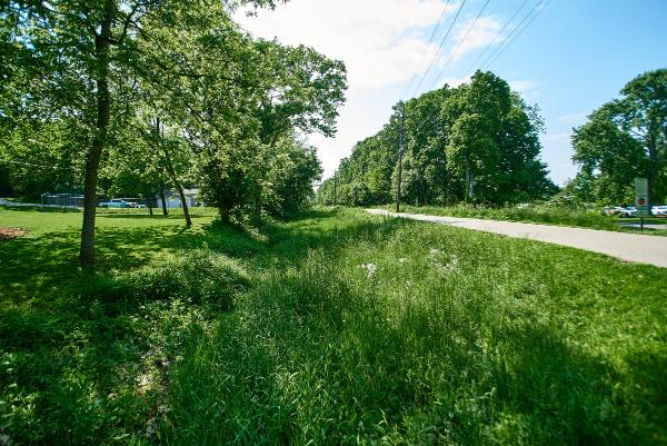
Miami & Erie Canal in Rentschler Forest MetroPark
Miami & Erie Canal in Rentschler Forest MetroPark
Miami & Erie Canal in Rentschler Forest MetroPark
A more recent view of the Miami & Erie Canal Kennedy Creek aqueduct remains in Rentschler Forest Metropark.
Close-up view of the Kennedy Creek aqueduct remains
Miami & Erie Canal in Rentschler Forest MetroPark
Miami & Erie Canal riprap overflow in Rentschler Forest MetroPark
Another view of the Miami & Erie Canal riprap overflow in Rentschler Forest MetroPark
Reigart Road east of the Rentschler Forest Metropark entrance
Historic photo of the Miami & Erie Canal LeSourdsville/Gregory Creek Aqueduct in approximately 1890
Remains of the Miami & Erie Canal LeSourdsville/Gregory Creek Aqueduct at Monroe Bicentennial Commons
Miami & Erie Canal route through Monroe Bicentennial Commons, formerly LeSourdsville Lake Amusement Park
Miami & Erie Canal route through Monroe Bicentennial Commons, formerly LeSourdsville Lake Amusement Park
Miami & Erie Canal right-of-way behind the former Harding-Jones paper mill in Excello
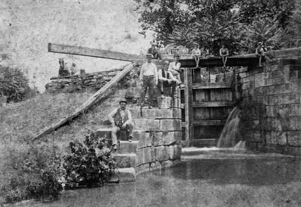
Miami & Erie Canal right-of-way and the Excello lock as seen from Main Street
Historic photo of the Miami & Erie Canal Excello lock #34 in approximately 1900
Historic photo of the Miami & Erie Canal Excello lock #34 in approximately 1905
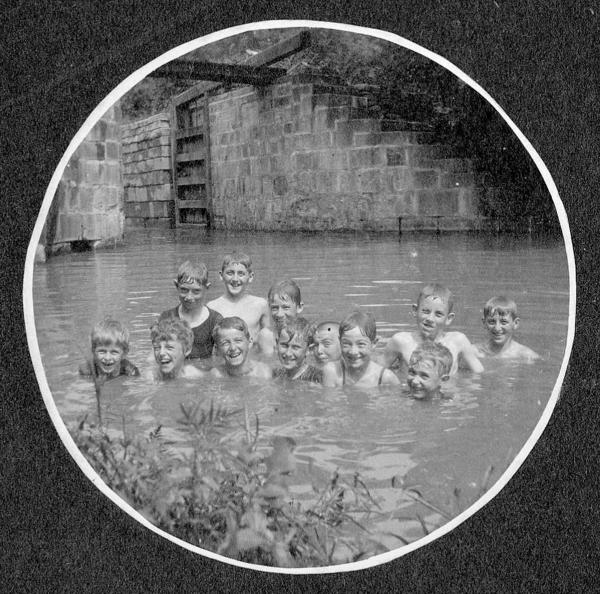
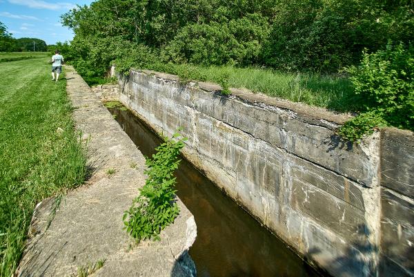
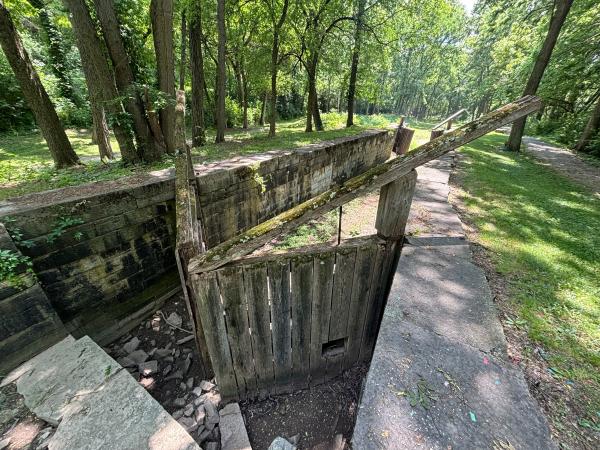
Miami & Erie Canal Excello lock #34
Miami & Erie Canal Excello lock #34
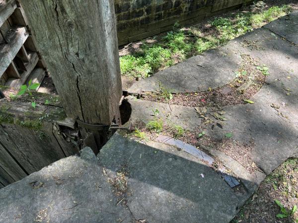
Detail of the Miami & Erie Canal Excello lock's upper gate pivot slot
Inside the Miami & Erie Canal Excello lock
Approaching the Miami & Erie Canal Excello lock, looking west from the canal bed
Miami & Erie Canal just above the Excello lock
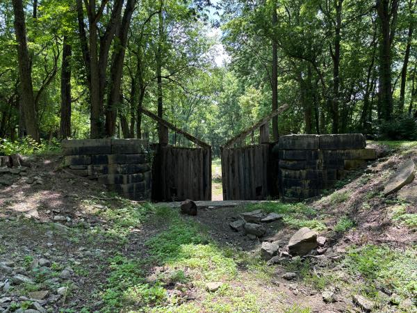
Miami & Erie Canal Excello lock #34
Miami & Erie Canal Excello lock #34
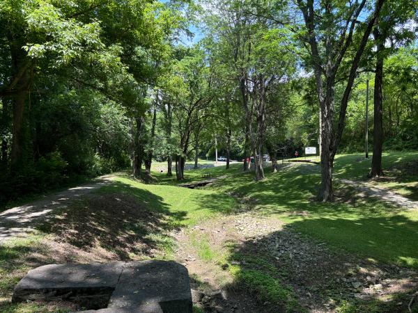
Miami & Erie Canal Excello lock #34 and spillway
Historic photo of the Miami & Erie Canal aqueduct over Dick's Creek in Excello in approximately 1890
Another historic photo of the Miami & Erie Canal aqueduct over Dick's Creek in Excello in approximately 1890
Historic photo of the Miami & Erie Canal aqueduct over Dick's Creek in Excello in 1910
Remnants of the Miami & Erie Canal Amanda's Mill lock #33 forming part of the foundation for Cohen Recycling's Middletown facility
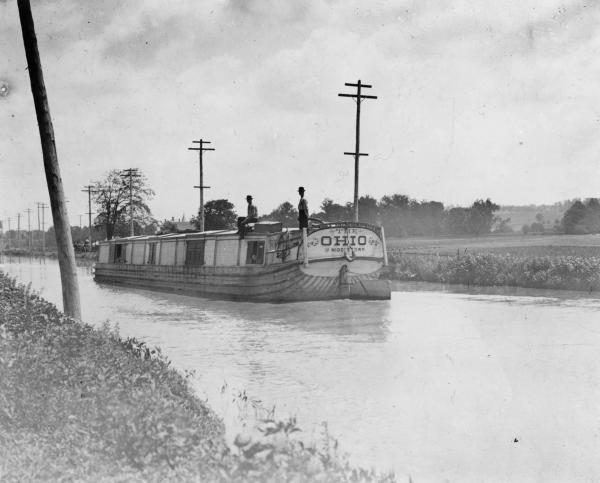
Historic photo of a canal boat on the Miami & Erie Canal near Middletown
Miami & Erie Canal route approaching central Middletown
Miami & Erie Canal route approaching central Middletown
Location of the Miami & Erie Canal and Warren County Canal intersection at the Middletown Transit Station
Route of the Warren County Canal in the center of Middletown
Route of the Warren County Canal in the center of Middletown along Reynolds Avenue
Route of the Warren County Canal in the center of Middletown along Reynolds Avenue
Route of the Warren County Canal in the center of Middletown at Curtis Street
Route of the Warren County Canal in the center of Middletown at Baltimore Street
Route of the Warren County Canal in Middletown at Garfield and Philadelphia
Route of the Warren County Canal in Middletown at Leibee and Philadelphia
Historic photo of the Miami & Erie Canal in Middletown in 1927
Current photo of the Miami & Erie Canal route from the previous photo
Miami & Erie Canal memorial fountain at Central and Verity in Middletown
Miami & Erie Canal memorial fountain at Central and Verity in Middletown
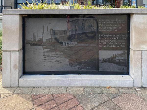
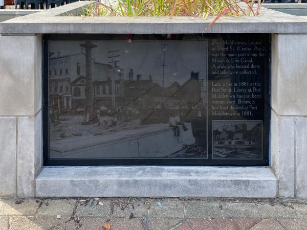
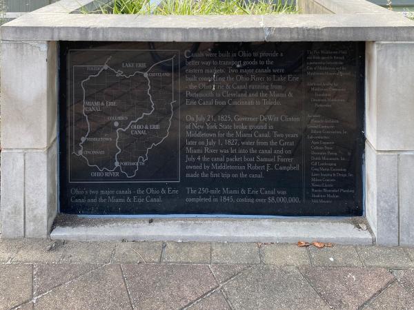
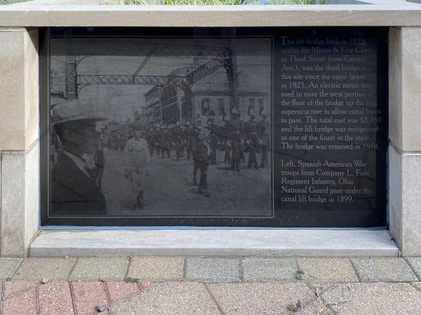
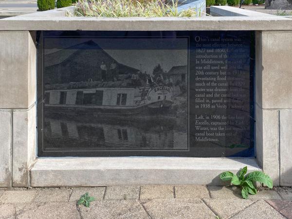
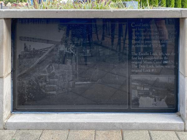
Miami & Erie Canal photo and information board at Central and Verity in Middletown
Miami & Erie Canal photo and information board at Central and Verity in Middletown
Miami & Erie Canal photo and information board at Central and Verity in Middletown
Miami & Erie Canal photo and information board at Central and Verity in Middletown
Miami & Erie Canal photo and information board at Central and Verity in Middletown
Miami & Erie Canal photo and information board at Central and Verity in Middletown
Miami & Erie Canal route at Verity and Vail in Middletown
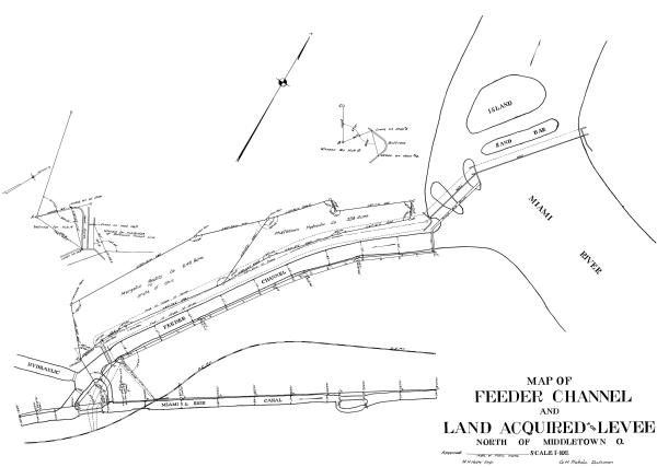
1920 plat map showing the Middletown feeder channel for the Miami & Erie Canal and Middletown Hydraulic
Miami & Erie Canal and Middletown Hydraulic Canal feeder headgate structure at Access Road and Verity Parkway
Miami & Erie Canal and Middletown Hydraulic Canal feeder headgate structure at Access Road and Verity Parkway
Miami & Erie Canal route crossing Dixie Highway at R Good Industries south of Franklin
Miami & Erie Canal Franklin/Clutch's Paper Mill lock #28 is filled in to the top of the walls
Detail of the Miami & Erie Canal Franklin/Clutch's Paper Mill lock #28 wall
Possible remnants of the Miami & Erie Canal aqueduct over Clear Creek south of Franklin
Miami & Erie Canal Sunfish Lock near Crains Run Nature Park about halfway between Franklin and Miamisburg
Miami & Erie Canal Sunfish Lock above the lower gate
Miami & Erie Canal Sunfish Lock above the upper approach
Detail of the Miami & Erie Canal Sunfish lock's upper gate pivot slot
Miami & Erie Canal at Benner Road in Middletown
Miami & Erie Canal underneath the former Big Four, now Norfolk Southern Railroad, south of Miamisburg
Miami & Erie Canal underneath the former Big Four, now Norfolk Southern Railroad, south of Miamisburg
Miami & Erie Canal underneath the former Big Four, now Norfolk Southern Railroad, south of Miamisburg
Miami & Erie Canal underneath the former Big Four, now Norfolk Southern Railroad, south of Miamisburg
Miami & Erie Canal below the former Big Four, now Norfolk Southern Railroad, south of Miamisburg
Miami & Erie Canal south of Miamisburg
Miami & Erie Canal south of Miamisburg
Miami & Erie Canal south of Miamisburg
Possible Miami & Erie Canal stones south of Miamisburg
Miami & Erie Canal south of Miamisburg
Miami & Erie Canal south of Miamisburg
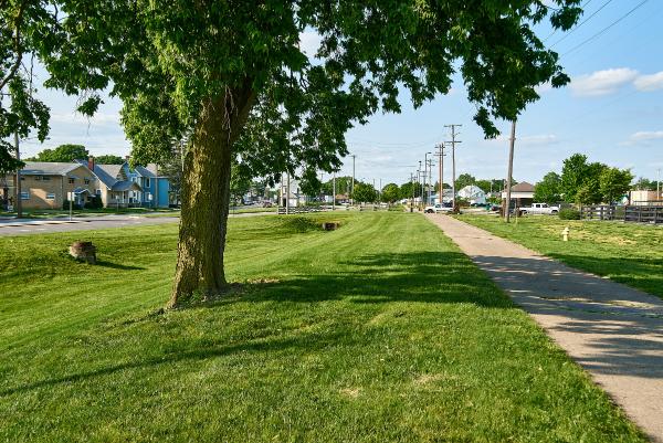
The end of the Miami & Erie Canal trench near the entrance to Miamisburg Community Park
The end of the Miami & Erie Canal trench near the entrance to Miamisburg Community Park
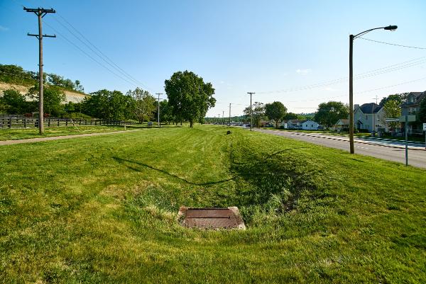
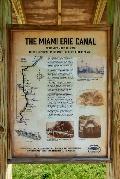
Miami & Erie Canal historical marker in Miamisburg Community Park
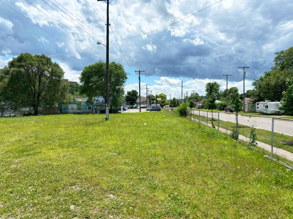
Location of Miami & Erie Canal Miamisburg lock #26 at Lock Street and 1st Street
Miami & Erie Canal right-of-way and canal-era buildings along 1st Street in Miamisburg
Miami & Erie Canal right-of-way and canal-era buildings at 1st and Linden in Miamisburg
Miami & Erie Canal right-of-way and canal-era buildings at 1st and Linden in Miamisburg
Miami & Erie Canal right-of-way and canal-era buildings south of Central Avenue
Miami & Erie Canal right-of-way and canal-era buildings at 1st and Central Avenue
Miami & Erie Canal right-of-way at the Miamisburg municipal building at 1st and Central Avenue
Miami & Erie Canal right-of-way approaching Pearl Street in Miamisburg
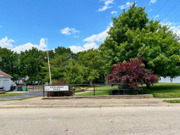
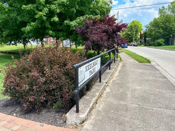
Miami & Erie Canal right-of-way and Keelboat Park at Pearl Street in Miamisburg
Detail of the Keelboat Park railing
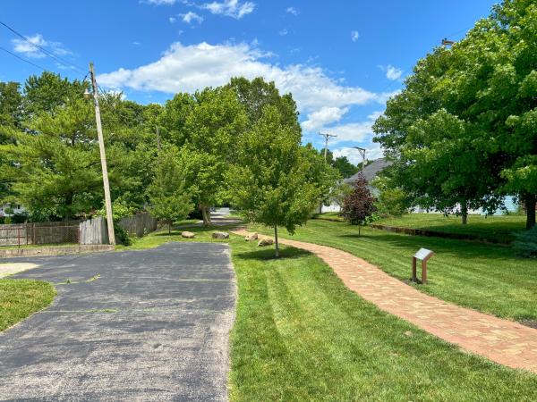
Miami & Erie Canal right-of-way inside Keelboat Park at Pearl Street in Miamisburg
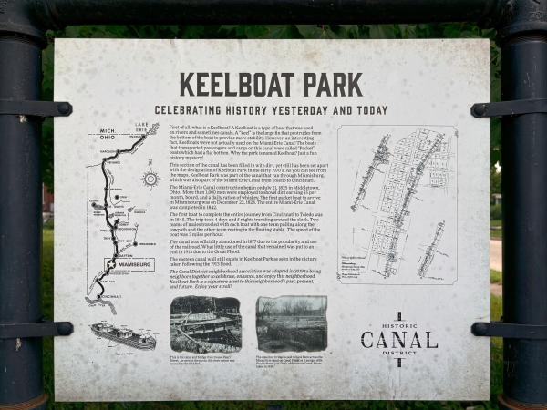
Keelboat park historical plaque
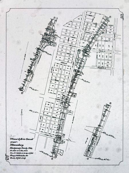
Detail of the map from the previous photo
Miami & Erie Canal right-of-way inside Keelboat Park in Miamisburg
Miami & Erie Canal right-of-way crossing Sycamore Street in Miamisburg
Miami & Erie Canal right-of-way on Canal Street in Miamisburg
Miami & Erie Canal Sycamore Creek Aqueduct in Miamisburg
Miami & Erie Canal Sycamore Creek Aqueduct in Miamisburg
Miami & Erie Canal Sycamore Creek Aqueduct in Miamisburg
Close up view of the Miami & Erie Canal Sycamore Creek Aqueduct in Miamisburg
Miami & Erie Canal Sycamore Creek Aqueduct in Miamisburg
Close up view of the Miami & Erie Canal Sycamore Creek Aqueduct in Miamisburg
False canal bed along Dixie Avenue north of Miamisburg
Miami & Erie Canal spillway culverts along Dixie Avenue north of Miamisburg
Miami & Erie Canal overflow channel under the Miamisburg & Carrollton Hydraulic near West Main and Weir Street in West Carrollton
Miami & Erie Canal overflow channel under the Miamisburg & Carrollton Hydraulic near West Main and Weir Street in West Carrollton
Miami & Erie Canal overflow channel under the Miamisburg & Carrollton Hydraulic near West Main and Weir Street in West Carrollton
Typical view of the Miamisburg & Carrollton Hydraulic along Hydraulic Road near the sewage treatment plant in West Carrollton
Historic photo of the Miami & Erie Canal at 5th and St. Clair Street in Dayton
Current photo of Patterson Boulevard and St. Clair Street at 5th Street in Dayton
Patterson Boulevard next to Cooper Park between 2nd and 3rd Street in Dayton
Reconstructed canal at 2nd and Patterson
Historic canal-era warehouse buildings at 1st and Patterson
Another view of the historic canal-era warehouse buildings at 1st and Patterson and their relationship to the canal
More reconstructed canal between 1st and Monument
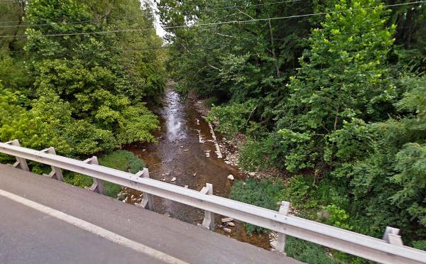
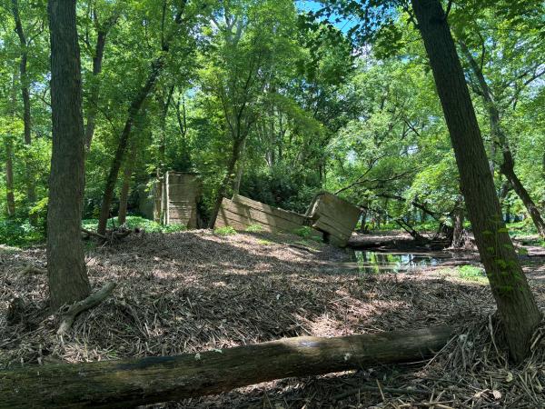
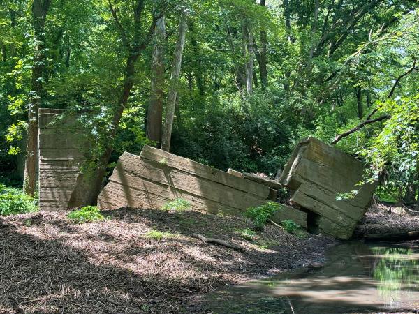
Historic photo of the Miami & Erie Canal's Mad River aqueduct on March 23, 1911
Another historic photo of the Miami & Erie Canal's Mad River aqueduct in 1898
Location of the Miami & Erie Canal's Mad River aqueduct
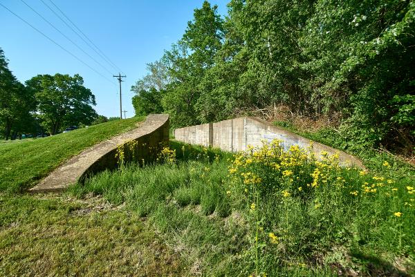
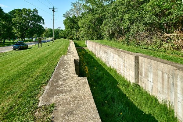
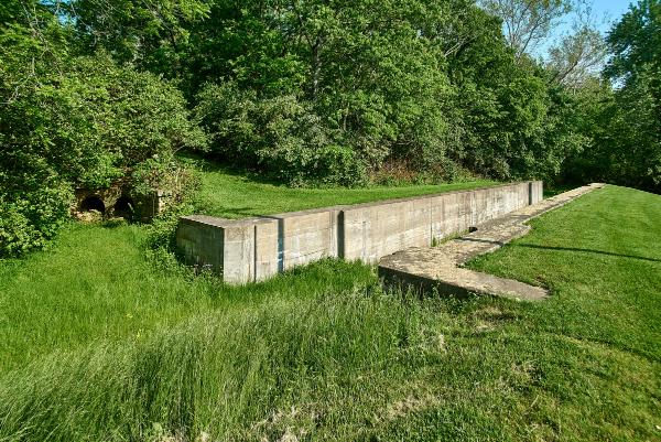
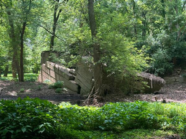
Remains of the Miami & Erie Canal's Mad River aqueduct south abutment
The other side of the Miami & Erie Canal's Mad River aqueduct south abutment
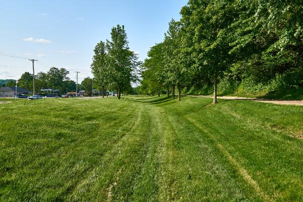
Miami & Erie Canal channel and towpath along Endicott Road in Huber Heights
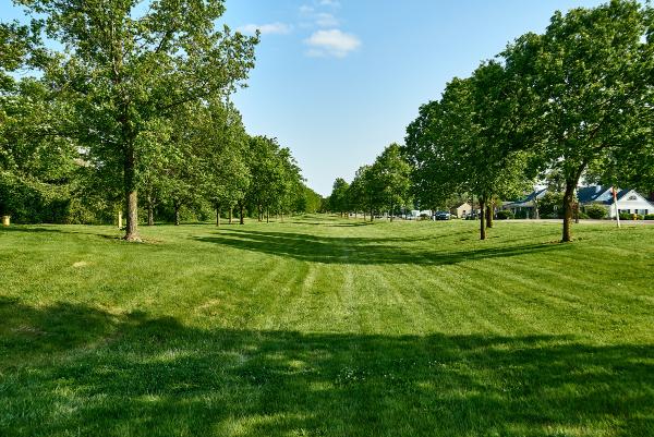
Miami & Erie Canal channel and towpath in Canal Lock Park in Huber Heights
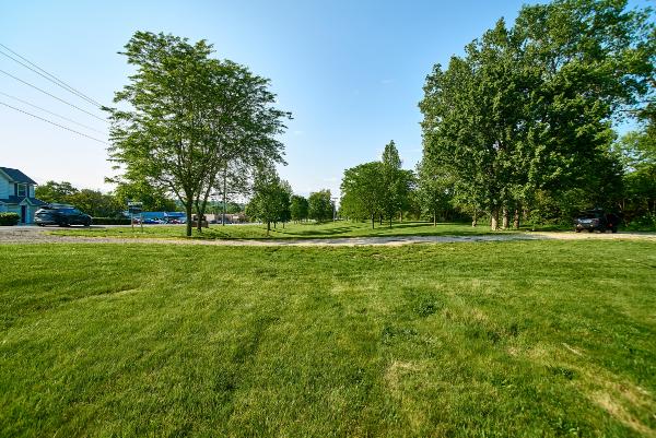
Miami & Erie Canal channel in Canal Lock Park in Huber Heights
Miami & Erie Canal channel and heelpath in Canal Lock Park in Huber Heights
Miami & Erie Canal channel and heelpath in Canal Lock Park in Huber Heights
Miami & Erie Canal channel and lock #18 in Canal Lock Park in Huber Heights
Miami & Erie Canal channel and lock #18 in Canal Lock Park in Huber Heights
Miami & Erie Canal channel and lock #18 in Canal Lock Park in Huber Heights
South end of Miami & Erie Canal lock #18 in Canal Lock Park in Huber Heights
North end of Miami & Erie Canal lock #18 in Canal Lock Park in Huber Heights
North end of Miami & Erie Canal lock #18 in Canal Lock Park in Huber Heights
North end of Miami & Erie Canal lock #18 in Canal Lock Park in Huber Heights
North end of Miami & Erie Canal lock #18 in Canal Lock Park in Huber Heights
North end of Miami & Erie Canal lock #18 in Canal Lock Park in Huber Heights
Miami & Erie Canal channel north of lock #18 in Canal Lock Park in Huber Heights
Miami & Erie Canal channel north of lock #18 in Canal Lock Park in Huber Heights
Miami & Erie Canal channel north of lock #18 in Canal Lock Park in Huber Heights
Miami & Erie Canal channel north of Fishburg Road
Historic photo of the derelict Miami & Erie Canal Taylorsville aqueduct over the Great Miami River in 1909
Historic photo of the replacement Miami & Erie Canal Taylorsville aqueduct over the Great Miami River just before the great flood of 1913
Miami & Erie Canal Taylorsville aqueduct west abutment
Miami & Erie Canal Taylorsville aqueduct west abutment
Miami & Erie Canal Taylorsville aqueduct west abutment
Miami & Erie Canal bed approaching the Taylorsville Dam and Great Miami River
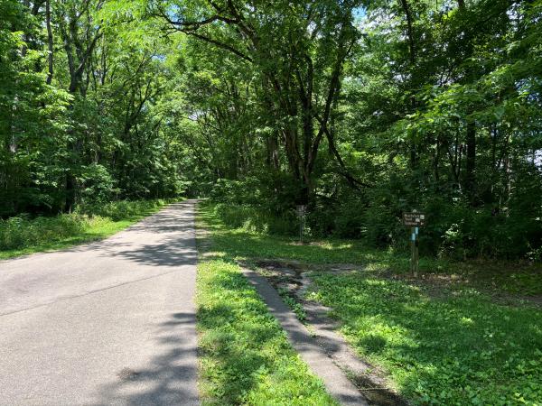
Miami & Erie Canal bed crossing the Great Miami River Recreational Trail at Taylorsville
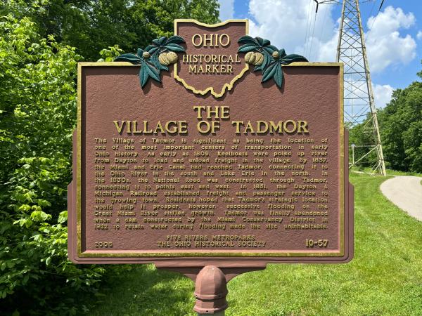
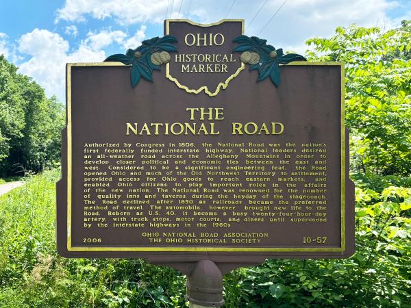
Village of Tadmor historical plaque next to the Great Miami River Recreational Trail and the Miami & Erie Canal
Village of Tadmor historical plaque next to the Great Miami River Recreational Trail and the Miami & Erie Canal
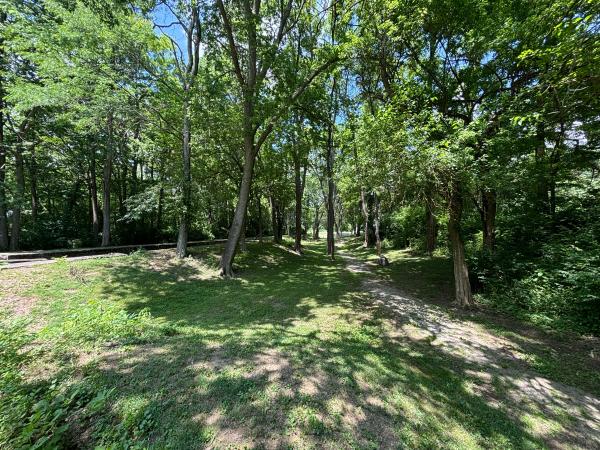
Miami & Erie Canal right-of-way approaching Main Street in Tipp City
Canal era building on Main Street in Tipp City
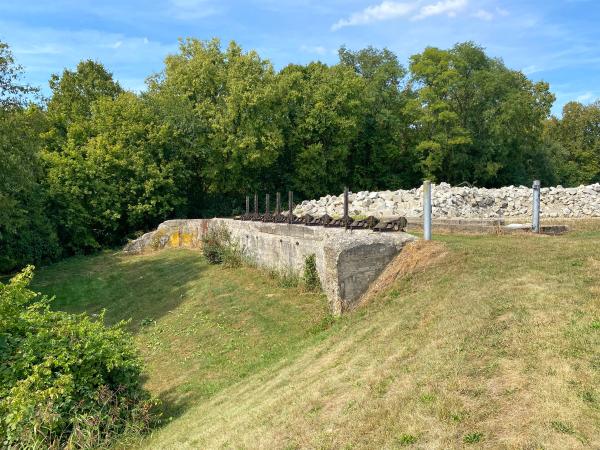
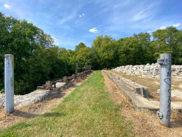
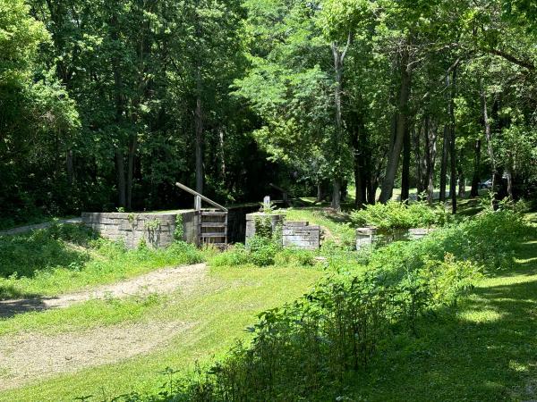
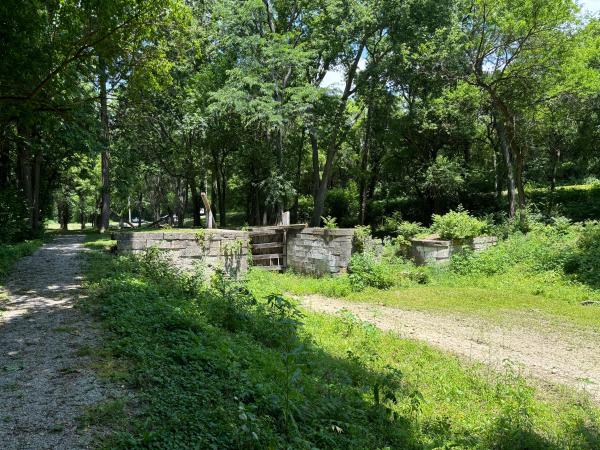
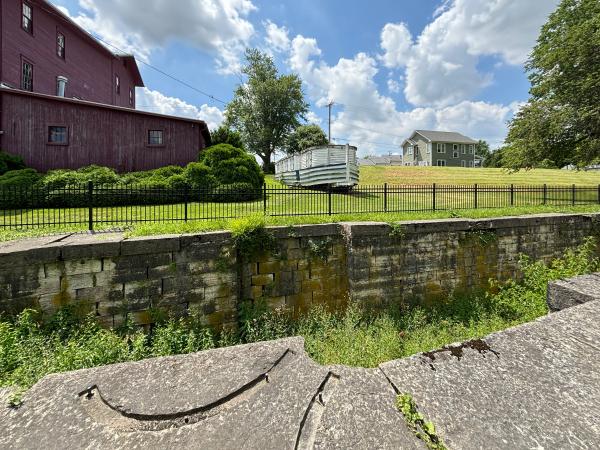
Miami & Erie Canal Lock #15 on Main Street in Tipp City
The Tipp Roller Mills next to Miami & Erie Canal Lock #15
Miami & Erie Canal Lock #15 on Main Street in Tipp City
Miami & Erie Canal Lock #15 on Main Street in Tipp City
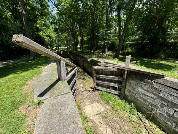
Detail of Miami & Erie Canal Lock #15 on Main Street in Tipp City
Reconstructed canal boat next to Miami & Erie Canal Lock #15 on Main Street in Tipp City
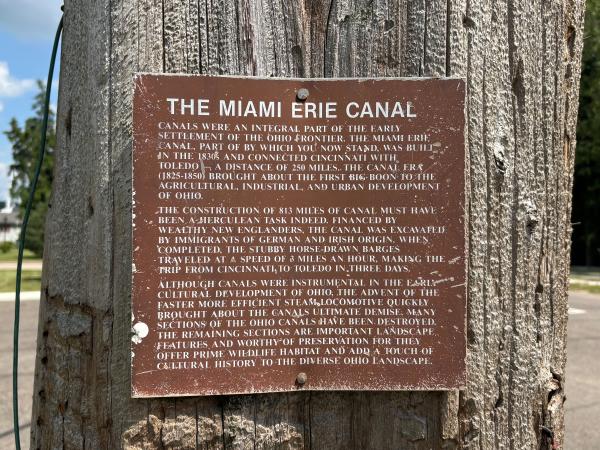
Historical marker next to Miami & Erie Canal Lock #15 on Main Street in Tipp City
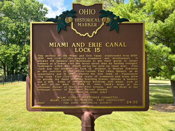
Historical plaque next to Miami & Erie Canal Lock #15 on Main Street in Tipp City
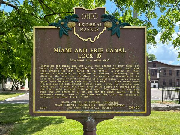
Historical plaque next to Miami & Erie Canal Lock #15 on Main Street in Tipp City
Miami & Erie Canal aqueduct remains over an unnamed creek in Tipp City next to Parkwood Drive
Miami & Erie Canal bed north of Tipp City near the DAP Products plant
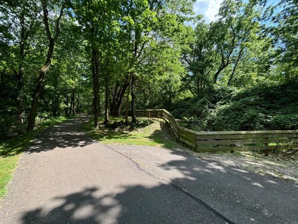
Miami & Erie Canal bed and the Great Miami River Recreational Trail on the towpath
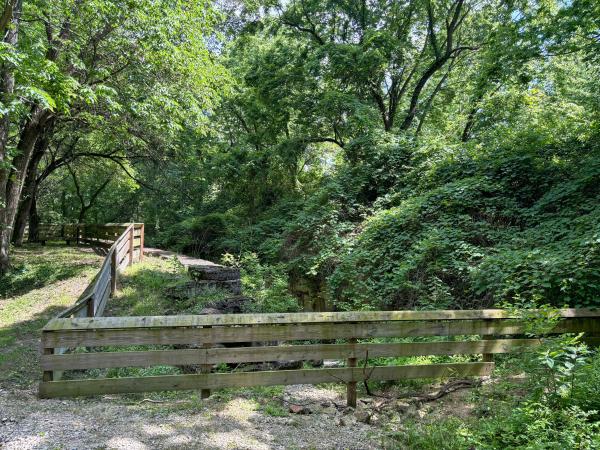
Miami & Erie Canal remnants of the lock #14 tender's house
Miami & Erie Canal remnants of the lock #14 tender's house
Miami & Erie Canal Boone's Lock #14
Miami & Erie Canal Boone's Lock #14
Miami & Erie Canal Boone's Lock #14
Miami & Erie Canal Boone's Lock #14
Miami & Erie Canal Boone's Lock #14
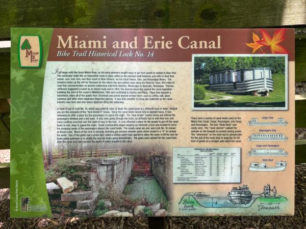
Miami & Erie Canal Boone's Lock #14 historical marker
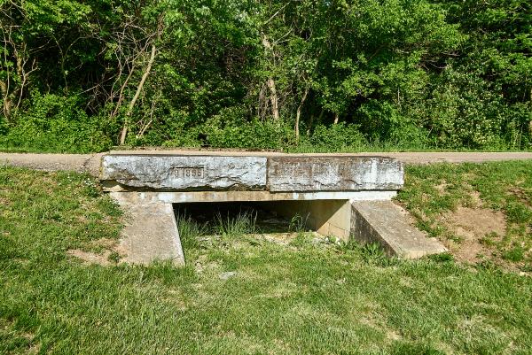
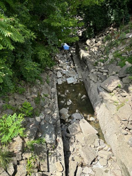
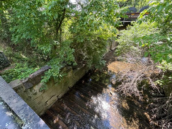
Miami & Erie Canal aqueduct remnants over an unnamed creek
Close up view of the canal trough location from the previous photo
Miami & Erie Canal aqueduct remnants over Peters Creek
Miami & Erie Canal aqueduct remnants over Peters Creek
Miami & Erie Canal aqueduct remnants over Peters Creek
Miami & Erie Canal aqueduct remnants over Peters Creek
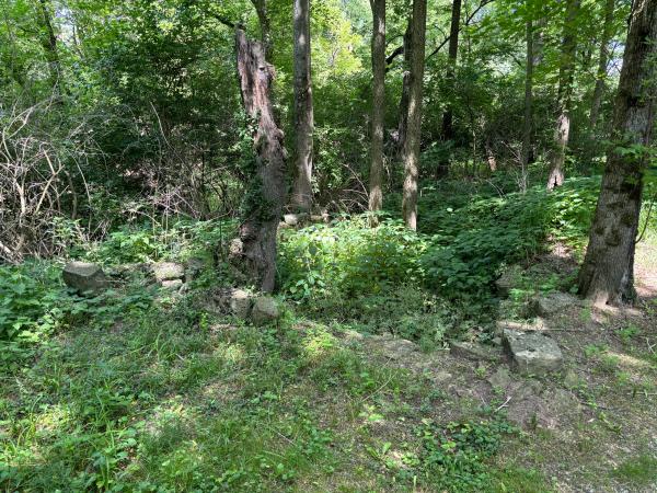
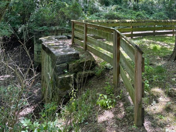
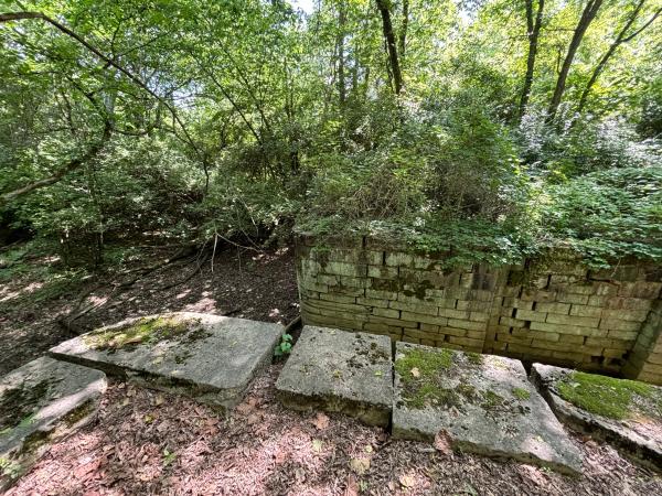
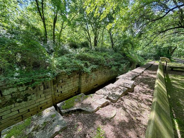
Miami & Erie Canal lock #13 south of Dye Mill Road in Troy
Close up of Miami & Erie Canal lock #13 south of Dye Mill Road in Troy
Miami & Erie Canal right-of-way approaching Dye Mill Road in Troy
Miami & Erie Canal right-of-way on the other side of Dye Mill Road in Troy
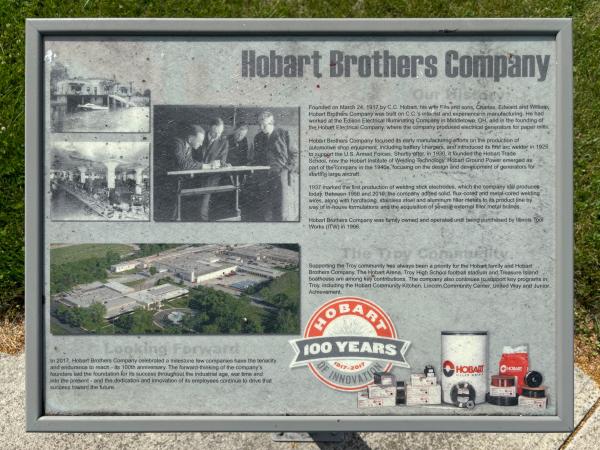
The former location of Miami & Erie Canal lock #12 and Hobart Brothers factory in Troy at Adams and West Main Street
Reconstructed portion of Miami & Erie Canal lock #12 next to Elm Street and Atlantic Street
Another view of the reconstructed portion of Miami & Erie Canal lock #12 next to Elm Street and Atlantic Street
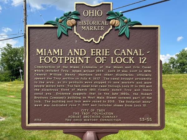
Miami & Erie Canal lock #12 historical plaque
Miami & Erie Canal lock #12 historical plaque
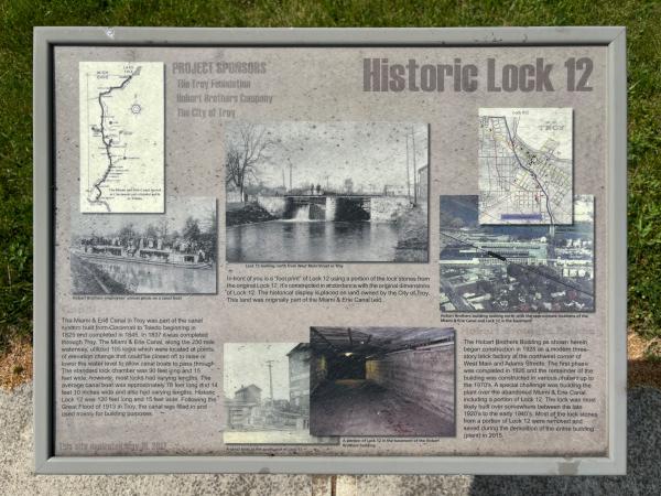
Miami & Erie Canal lock #12 historical marker
Miami & Erie Canal lock #12 historical marker
Miami & Erie Canal lock #12 historical marker
Generated by
jAlbum 23
,
Jupiter 9