Dedicated to the history of the Cincinnati area's streetcar, interurban, and railroad lines
- Navigation
- Navigation
Main Entrance
About This Site
Map
Streetcars
Interurban Railways
Railroads
Other
Links
Acknowledgments
References
Updates
01/05/2025
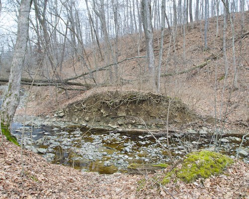
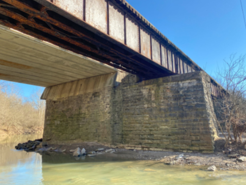
I have posted additional photos to several of the galleries, many of which are intertwined with one another. Specifically, I added numerous additional photos of the Miami & Erie Canal, starting with a couple shots of the route in Sawyer Point and some never before seen historical photos of the old mill race along Eggleston Avenue. There's a few additional photos in Hamilton and Rentschler Forest Metropark, as well as through the center of Miamisburg to the Sycamore Creek aqueduct which is still intact. I included a few photos of the Miamisburg & Carrollton Hydraulic too. The biggest addition is that I documented just about everything north of Dayton to Troy, including several locks and aqueducts.
The I&O, former Big Four, CIND gallery adds several photos of the Great Miami River bridge's old aqueduct abutment on the west bank of the river, some shots of the other aqueduct over Mill Creek, and some updated shots around the Clay Wade Bailey Bridge and Longworth Hall. I took some newer photos of the former Little Miami Railroad around Carrel Street in Columbia-Tusculum, plus the new bridge over O'Bannon Creek in Loveland, and the work around the Peter's Cartridge factory. The CG&P gallery also has some additional new photos from Carrel Street. The Chesapeake & Ohio Railroad gallery adds new photos of the viaduct replacement project between Gest and 5th Streets, as well as some refreshed photos near the Clay Wade Bailey Bridge and Longworth Hall that overlap with the Big Four CIND. The CH&D and Cincinnati & Westwood Railroad galleries add photos around Beekman Street and the Western Hills Viaduct. Some of those are also included in the Roads & Viaducts page. There are more photos of the CH&D in North Fairmount near Millcreek Road, and in Rentschler Forest Metropark north of Hamilton. The C&LE gallery adds two photos of Cincinnati Motor Terminals Company box trailers and a couple shots of the right-of-way north of Miamisburg.
04/09/2024
A few minor updates catch up on the sale of the Cincinnati Southern Railway to Norfolk Southern, while the history pages of the Cincinnati, Hamilton & Dayton Railroad and the Big Four Railroad to Columbus add information about reroutings in Hamilton and Franklin after the 1913 flood. I also added a link to the Grasshopper Railroad website, which details the history of the Waynesville, Port William and Jeffersonville Railroad. This was a short-lived narrow gauge railroad that ran from the Little Miami near Spring Valley Lake east towards Columbus. It eventually failed, was reorganized and converted to standard gauge as the Cincinnati, Columbus & Hocking Valley Railway, then it became the Ohio Southern Railway. The route between Cincinnati and Columbus was never completed, and it was bought out by the Detroit, Toledo & Ironton to operate as a minor branch line between Sedalia (now Midway) and Kingman, a tiny hamlet on OH-380 a mile north of the OH-73 exit off I-71. It was abandoned in the 1930s and 1940s.
08/06/2023
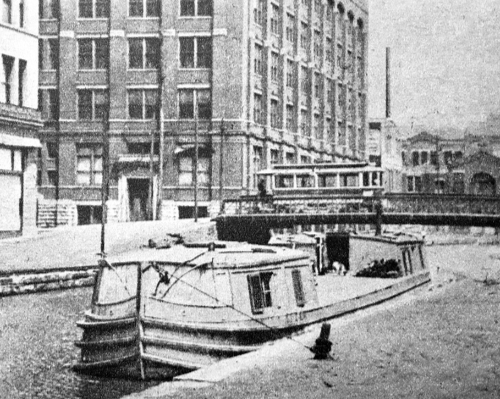
While I have given canals a cursory mention here as they relate to the railroads and the subway projects, they are no less obscure and are deserving of their own historical essays. Thus, I have added an extensive history of the Miami & Erie Canal, Warren County Canal, and Cincinnati Subway as a new history page along with numerous additional photos between Cincinnati and Dayton. Similarly the histories of the two former Big Four Railroad lines to the west, the Brookville subdivision and CIND subdivision have been updated with histories of the Whitewater Canal and Cincinnati & Whitewater Canal. Each of their photo galleries is also updated, especially the Brookville subdivision along the Whitewater Canal Trail through Metamora. The map is also updated to show the Warren County canal and the various hydraulic canals in the Miami Valley, along with some minor adjustments to the Miami & Erie route.
01/28/2023
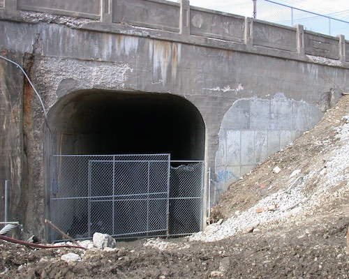
History and additional photos of the Cincinnati Western Railroad have been posted. The search for the tunnel portals stalled with no timeline for picking back up. However, the information and photos that were gathered are ready for sharing.
02/27/2022
Catching up on some overdue photo updates, I have revised galleries of the CM&B, East Walnut Hills and O'Bryonville streetcars, and Hyde Park and Madisonville streetcars. Thanks to Anthony Wood at Tap Wood Farm for photos of old CM&B bridge abutments at Stonelick Creek, and Kerry Devery for photos of exposed rails at Madison and Kenwood in Madisonville.
01/25/2022
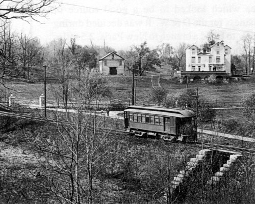
I have finally completed a major update to the history of the Cincinnati, Lawrenceburg & Aurora Electric Street Railroad. What was originally a somewhat anemic write-up has become one of the most comprehensive. While no books have been published on its history, the late Earl Clark Jr. had amassed a great deal of resources, including numerous photographs from the collection of the late Cliff Scholes, among others, that I have added to the galleries of the main line and Harrison branch. Many thanks to Bill Van Doren for loaning me Earl's research. Additional thanks go to Lou Lockwood and Robert Deffinger for providing more historical information.
The extensive CL&A updates include a revised map, which has already been online for a couple of weeks while I've ironed out performance issues and tested a new production workflow. In addition I imported a much better quality base road map for Montgomery County. Since the CL&A history is very much intertwined with that of the adjacent Big Four Railroad (now I&O CIND), I updated its history as well, including additional relevant photos. I expect to have some minor tweaks to these pages here and there, but they're now ready for publication.
BackgroundThe growth and development of cities throughout the world is profoundly influenced by the modes of transportation available to them. Until the 19th century, walking was the only way to get around town. Horses and carriages were generally only used for traveling between cities or by the wealthy. For the vast majority of folks, walking was their main mode of travel on a daily basis. Regardless of the time and the method of transit, on average people don't spend more than about 30 minutes to get anywhere on a regular basis. This limited the size of the walking city to about two miles across. The historical center of most European cities, as well as many east coast cities in the United States, were first developed in this walking age. The centers of London, Paris, Rome, New York, Boston, and Philadelphia all grew in this time. It wasn't until the introduction of the railroads that things started to change.
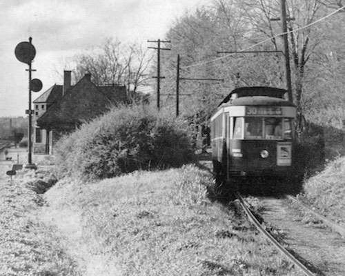
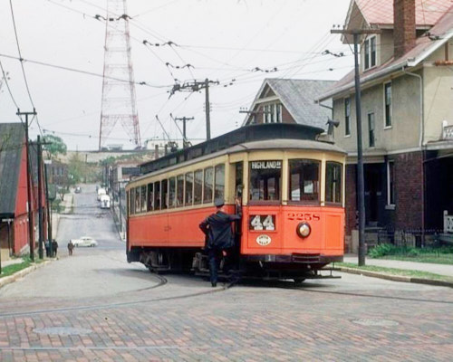
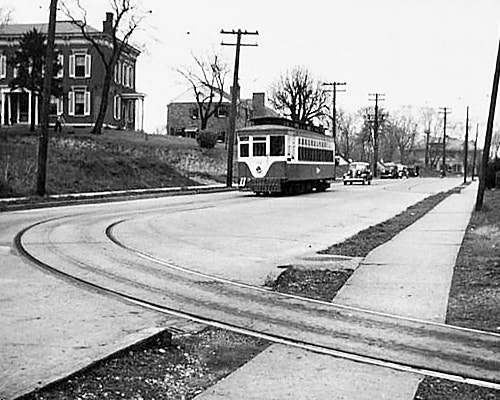
Three eras of transit vehicles pose for a special railfan trip on Montana Avenue on April 22, 1951, just one week before final abandonment of the streetcar system. A yellow 1940s PCC streetcar sits next to an older 100 series car from the 1920s, and the trolleybus that would replace them both is in the back. Information provided by Bill Myers, an attendee on this trip.
At first, railroads didn't affect the size of cities much. They linked the city with the countryside, spurring the growth of country towns where farmers brought their produce to be shipped to the city by train. Here in Ohio, any town with a population over 5,000 had a railroad connection of some sort. Towns such as Loveland, Montgomery, Springdale, Sharonville, and Newtown started in this way. In the big cities though, the change was increasing industrialization of certain areas of the city where the railroads had their yards and other support facilities. With the exception of some wealthy railroad commuter suburbs like Glendale, Wyoming, Terrace Park, and 19th century Norwood, most people still had to live within walking distance of work and their everyday needs, since the railroad was too expensive to use on a daily basis.
Although the railroads didn't start to change the growth pattern of cities significantly in themselves, with the exception of large cities with massive commuter rail networks like New York, Chicago, London, and Paris, some of the railroad's spin off technologies did change cities of all shapes and sizes. The development of steel rails and steam engines allowed for the construction of horsecar and cable car lines, as well as Cincinnati's famous inclines. These allowed more than just the very wealthy, who could afford to take a horse and carriage from neighborhoods like Clifton or East Walnut Hills to downtown, to start moving farther away from the increasingly crowded and polluted central city. It wasn't until the development of reliable electric traction motors that the spreading out of cities began in earnest.
In the late 1800's, slow and unreliable horsecar lines began converting to electric streetcars. While horsecar lines in some cities reached several miles from downtown, such as in Chicago, the topography of Cincinnati meant that they couldn't operate effectively to the hilltop communities. Cable cars work great in hilly terrain like Cincinnati and San Francisco, and even Chicago had an extensive system, but they were still slow, required extensive maintenance, and were prone to mechanical breakdowns. Electric streetcars were much faster and more reliable, so except in a few rare cases they replaced all the horsecar and cable car lines that preceded them. The streetcar systems which developed allowed cities to grow from two miles across to nearly 10 miles. Just about every neighborhood within the boundaries of the City of Cincinnati, outside of the core downtown and adjacent basin neighborhoods, grew during the streetcar's ascendancy.
At the same time, the interurbans took streetcar technology and applied it to longer-distance travel. They linked the city with the country much as the railroads had, but they provided more frequent and less expensive service. Unfortunately, just as quickly as the interurbans sprang up, they quickly disappeared due to competition from private automobiles and paved public highways. By the time of the Great Depression, most were gone. The streetcars hung on for another couple decades, but most of them disappeared by the 1950's.
Today, basically all cities in the United States, and more and more around the world, are completely dependent on the automobile, and to a lesser extent the diesel bus. The many neighborhoods and towns that grew up around the streetcars, interurbans, and railroads in most cases no longer have the transportation that they were built around. They have to function in a car-oriented society, and while some have been able to survive, many of these older neighborhoods are dysfunctional in some respect if not completely failing. Few people today remember the streetcars, let alone the interurbans. Today's mainline railroads are seen more as an annoyance when a large freight train holds up traffic, and their role as the lifeblood of small towns and big cities is mostly forgotten. I hope by documenting as much of the history of these rail systems as I can, that more people will understand and appreciate the significant impact they had on the growth of not only Cincinnati, but nearly every city in the United States.
Other ResourcesSome large cities around the country have web sites with information about former transit systems. It's not difficult to find maps, photos, detailed history, and commentary on the Chicago 'L', the New York Subway, or the Pacific Electric in Los Angeles. For smaller cities like Cincinnati, information can be pretty hard to come by. There were many very small systems in cities you wouldn't expect that are almost completely forgotten. The surface lines of Charleston, South Carolina aren't well-documented at all, and the trolley line which connected Southern Pines with Pinehurst, North Carolina is a complete mystery. Even locally, the small streetcar systems of Hamilton or Springfield have little to no available published history. Aside from a few short descriptions, photos or maps are virtually nonexistent. This is something I am trying to provide, at least for the greater Cincinnati area.
Most of the information on Cincinnati's transit history is in books and journals which are inaccessible on the internet and are becoming rarer as time goes on. Wagner & Wright's Cincinnati Streetcars is an invaluable 10 volume collection that has numerous historical photographs, maps, diagrams, and general history. While some photos are distributed digitally, much of the historic information is not. Also, most of these volumes are out of print, and some can be rather difficult to find. The Cincinnati Historical Society Library in Union Terminal has all volumes, but they can't be checked out. Other information is in pamphlets and local history journals that never had much circulation outside of their home territory.
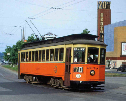
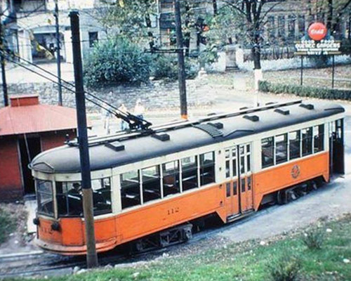
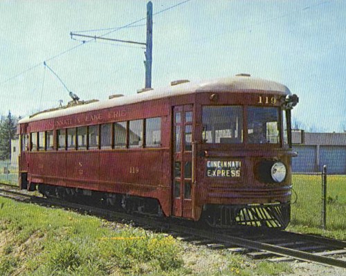
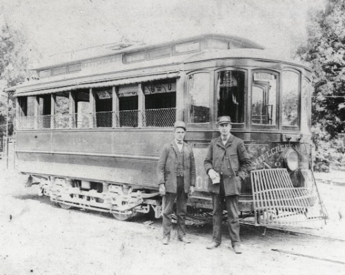
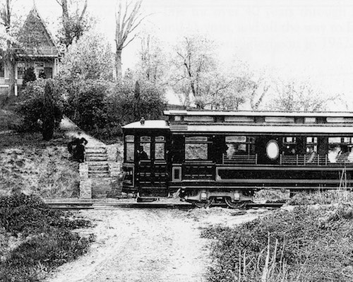
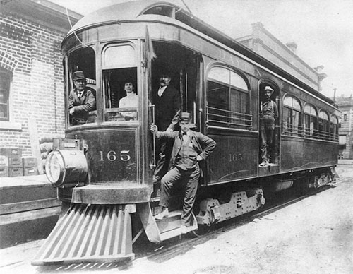
An interurban car for the Cincinnati, Lawrenceburg & Aurora. These were larger, heavier, and faster than streetcars, looking like a hybrid of a streetcar and a steam railroad passenger car.
Information on the interurbans is spotty. George Hilton and John Due's The Electric Interurban Railways in America is the go-to reference for the interurban industry. It has been recently republished and is readily available. However, aside from what I have quoted in the information sections for each company, there isn't much else in that book about the specific interurbans in Cincinnati. Some books have been written on individual interurbans, however. David McNeil self-published books on the Cincinnati Georgetown & Portsmouth, Cincinnati & Columbus, the Cincinnati & Lake Erie, and the Cincinnati Milford & Blanchester. Copies can be rather difficult to find, but they are excellent resources, containing maps, pictures, history, news events, and numerous business records (especially for the CG&P). Nothing of much substance has been written specifically about the Cincinnati Lawrenceburg & Aurora, the Cincinnati & Hamilton, or the three Interurban Railway & Terminal lines. The Electric Railway Journal, a trade publication from the time of streetcar and interurban building, sometimes wrote articles about new companies, especially if they used innovative new technologies. More and more of those are being digitized and shared, though the thousand-plus page volumes can be quite cumbersome to read through, and they mainly only cover the early construction and operations, or major efforts at economizing operations.
There is an excellent book about local railroads. The Railroad and the City by Carl Condit provides very useful information about the history of all Cincinnati's railroads, and how they've affected growth throughout the region. There is also some information on the interurbans. This book was published in 1977, so it predates the post-Conrail mergers by CSX and Norfolk Southern, but it is still an excellent resource. Other railroads have been dealt with in some capacity by separate authors, such as the Cincinnati, Lebanon & Northern in John Hauck's book Narrow Gauge in Ohio, as well as the various Pennsylvania Railroad lines and some of the smaller narrow gauge systems. See the non-internet references at the bottom of this page for the full list.
The MapThe map on this site is something I put together from personal on-the-ground exploration, maps from books, libraries, or the USGS, and information from knowledgeable folks. This map does not represent the system as it would have appeared at any one point in time. It's more a map of where there have ever been streetcar, interurban, and railroad lines, as if you took all the maps ever made and overlaid them. The purpose is for those who are curious about whether there are/were tracks buried under the road they're driving on, or if the trolley poles holding up the traffic lights were actually for streetcars, or if a berm in the woods might be an old right-of-way. I have tried to differentiate between active and abandoned railroads, but I cannot be certain that lines aren't abandoned or just infrequently used. Of course, all the interurbans and streetcars are gone. Other transit infrastructure such as tunnels, major viaducts, canals, and major passenger and freight stations have also been added. Most of that information has been gathered from early 1900s USGS topographic maps. Therefore, some later changes may have been missed. While I have tried to make everything as correct as possible, I cannot make any guarantees about accuracy.
PicturesWhile exploring around town looking for information I took pictures of my on-site reconnaissance. There are hundreds of photos from all over the area, most starting around the year 2001. More and more pictures depict scenes that have already changed, removing traces of transit history that were once obvious. While most railroad aficionados take pictures of locomotives and other train movements, my focus is on rights-of-way, bridges, tunnels, buildings, and other examples of the physical plant. These are the things that most people see, but tend to ignore. What may be the obvious remains of a railroad line one day can be reduced to a mere memory after road construction or another building project. Someone could be living right on top of a line that was once an immensely important transit route for a community and not even know it. Photographs help bring to life some of the history that surrounds us. In more recent years I have added numerous historical photos from library archives and generous contributors.
I welcome any feedback, corrections, links, pictures, or questions you have, don't hesitate to e-mail me.
.jpg)

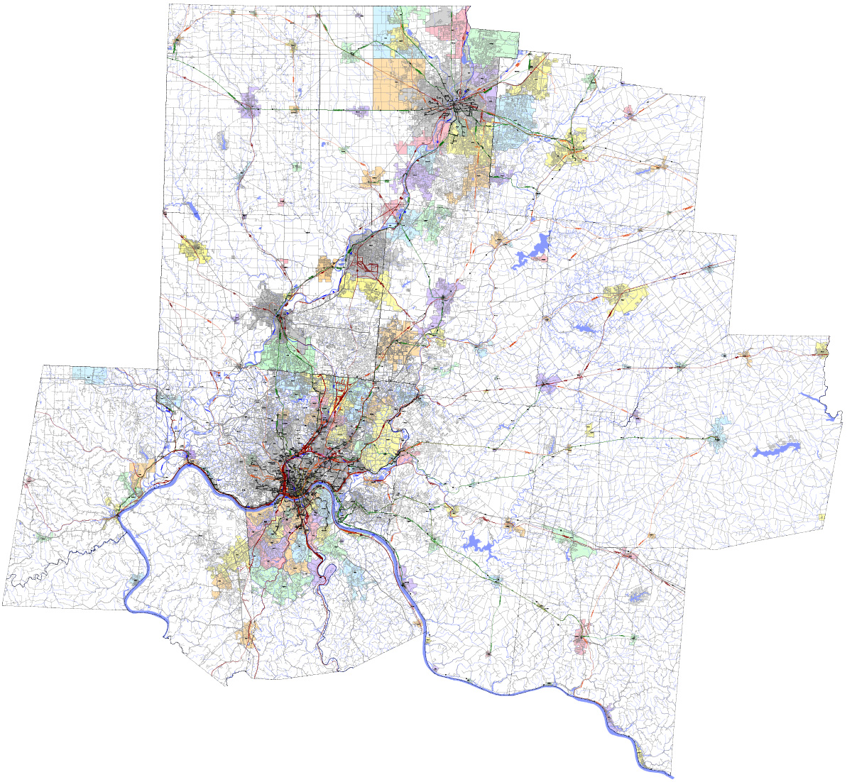
Click on the image below to open the map in a new window
- Photographs
- Anderson Ferry & Fernbank
- Brighton, Camp Washington, Northside, & College Hill
- Downtown & Over-the-Rhine
- East End & Columbia Parkway
- East Walnut Hills & O'Bryonville
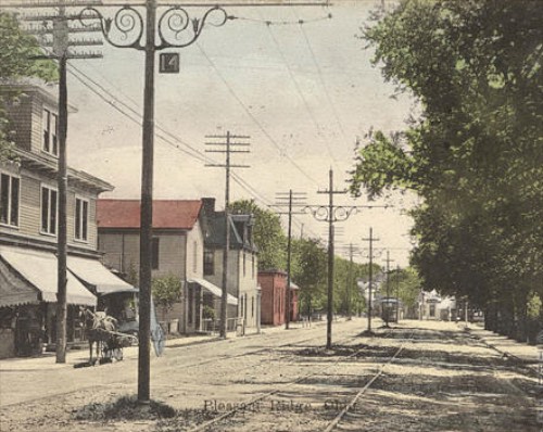
- Evanston, Norwood, Pleasant Ridge, & Kennedy Heights
- Fairmount & Westwood
- Fairview, Clifton Heights, & Clifton
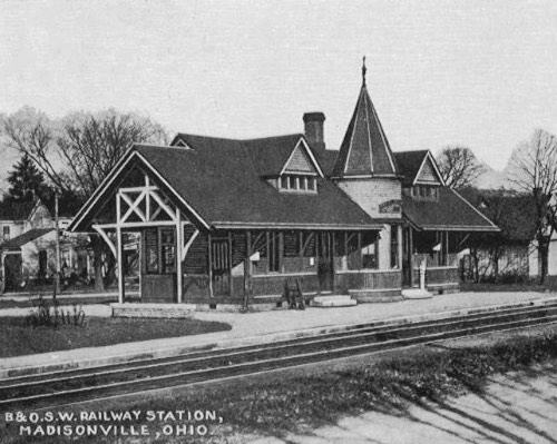
- Hyde Park, Madisonville, & Mariemont
- Mt. Adams, Eden Park, & Walnut Hills
- Mt. Auburn & Avondale
- Mt. Lookout & Oakley
- Queensgate, Lower Price Hill, & Price Hill
- St. Bernard, Elmwood Place, Carthage, Hartwell, Wyoming, & Springdale
- Winton Place (Spring Grove Village)
- Kenton County Kentucky
- Campbell County Kentucky
- End of Line Loops
- Trolley Wire Support Poles
- Substations, Carbarns, and Shops

Interurban Railways & Suburban Railroads
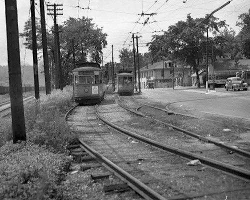
CL&A - Cincinnati, Lawrenceburg & Aurora Electric Street Railroad Anderson Ferry - Aurora, IN, branch to Harrison
Standard gauge line constructed by the Cincinnati, Lawrenceburg & Aurora Electric Street Railroad in 1900
Abandoned and dismantled west of Fernbank in 1930 Remainder to Anderson Ferry purchased by the Cincinnati Street Railway, for suburban service until 1940
More Information
Main Line Photographs from Anderson Ferry to Aurora
Harrison Branch Photographs from Valley Junction to Harrison
Cincinnati & Westwood Railroad
South Fairmount - Westwood
Narrow gauge line constructed by the Cincinnati & Westwood Railroad in1874
Converted to Standard Gauge, 1891
Abandoned in 1926
More Information
Photographs from South Fairmout to Westwood
C&LE - Cincinnati & Lake Erie Railroad (College Hill Railroad, Ohio Electric Railway, Etc.)
Winton Place - Detroit, MI
Narrow gauge steam line constructed by the College Hill Railroad to Mt. Healthy in 1873
Converted to standard gauge and electrified in 1901-1902 after purchase by the Southern Ohio Traction Company
Merged into the Ohio Electric Railway and eventually reorganized as the Cincinnati & Lake Erie
Abandoned and dismantled in 1939
More Information
Main Line Photographs from Northside to Miamisburg
Freight Branch Photographs from College Hill to Mt. Healthy
Cincinnati & Hamilton Traction Company (Ohio Traction Company, Mill Creek Valley Line)
Hartwell - Hamilton
Broad gauge line constructed by the Cincinnati & Hamilton Traction Company in 1901
Abandoned and dismantled north of Springdale in 1926, remainder purchased by Cincinnati Street Railway for suburban service until 1932
More Information
Photographs from Hartwell to Springdale
IR&T - Interurban Railway & Terminal: Rapid Railway
Kennedy Heights - Lebanon
Broad gauge line constructed by the IR&T's Rapid Railway subsidiary in 1903
Abandoned and dismantled in 1922
More Information
Photographs from Pleasant Ridge to Lebanon
IR&T - Interurban Railway & Terminal: Suburban Traction Company
Columbia - Bethel
Broad gauge line constructed by the IR&T's Suburban Traction Company in 1903
Abandoned and dismantled north of Coney Island in 1918
More Information
Photographs from California to Amelia
IR&T - Interurban Railway & Terminal: Cincinnati & Eastern Electric Railway
Columbia - New Richmond
Broad gauge line constructed by the IR&T's Cincinnati & Eastern Electric Railway in 1902
Abandoned and dismantled in 1922
More Information
Photographs from California to New Richmond
C&C - Cincinnati & Columbus Traction Company (Hillsboro Short Line, Swing Line)
Norwood - Hillsboro
Standard gauge line constructed by the Cincinnati & Columbus Traction Company in 1906
Abandoned and dismantled in 1920
More Information
Photographs from Norwood to Hillsboro
CM&B - Cincinnati, Milford & Blanchester Traction Company (Cincinnati, Milford & Loveland Traction Company, Milford Line, Kroger Line)
Madisonville - Blanchester
Broad gauge line constructed by the Cincinnati, Milford & Loveland Traction Company in 1903
Reorganized as the Cincinnati, Milford & Blanchester Traction Company in 1918
Abandoned and dismantled east of Milford in 1926, remainder purchased by Cincinnati Street Railway for suburban service until cut back to Mariemont in 1936, and abandoned and dismantled completely in 1942
More Information
Photographs from Madisonville to Blanchester
CG&P - Cincinnati, Georgetown & Portsmouth Railroad
Columbia - Georgetown, branches to California, Batavia, Russellville, and Felicity
Narrow gauge, steam line constructed by the Cincinnati & Portsmouth Railroad, 1876-1886
Renamed the Cincinnati, Georgetown & Portsmouth Railroad, 1880
Converted to Standard Gauge & Electrified, 1902
Batavia, Russellville, and Felicity & Bethel branches completed, 1903-1906
Reorganized as the Cincinnati-Georgetown Railroad Co., 1927
Service cut back and eventually abandoned, remaining route between Carrell Street and the waterworks sold to the city, 1933-1936
City/waterworks use suspended, 1943
More Information
Main Line Photographs from Columbia-Tusculum to Russellville
California Branch Photographs from California Woods to Coney Island
Batavia Branch Photographs from Olive Branch to Batavia
L&F - Lebanon & Franklin Traction Company
Lebanon-Franklin
Standard gauge line constructed by the Lebanon & Franklin Traction Company in 1904
Abandoned and dismantled in 1919
More Information
Photographs from Lebanon to Franklin
D&W - Dayton & Western Traction Company
Dayton-Richmond, Indiana, branch to New Paris
Standard gauge line constructed by the Dayton & Western Traction Company, 1898-1903
Leased to the IC&E and Ohio Electric Railway in 1906/1907
Returned to original owners in 1920
Line goes bankrupt and is operated under receivership by the CL&E in 1931
Leased to Indiana Railroad in 1936
Abandoned and dismantled in 1937 except short Drexel extension taken over by street railway
Drexel extension abandoned in 1947
More Information
Main Line Photographs from Dayton to Richmond, Indiana
New Paris Branch Photos from New Westville to New Paris

Railroads
- Baltimore & Ohio/Cincinnati,
Hamilton & Dayton - CSX, Cincinnati
Terminal Subdivision
Former Cincinnati, Hamilton & Dayton/Baltimore & Ohio to Lima
Standard gauge line opened to Dayton in 1851
Downtown terminal: Baymiller Street Station (5th & Baymiller Streets)
Mostly abandoned south of Ivorydale (St. Bernard), in active use north of Ivorydale
More Information
Photographs from Queensgate to Hamilton

Baltimore & Ohio to Columbus - Indiana & Ohio, Midland Subdivision
Former Marietta & Cincinnati/Cincinnati Washington & Baltimore/Baltimore & Ohio to Columbus
Standard gauge line opened in stages from 1855 to 1864
Downtown terminal: Central Union Depot (3rd Street & Central Avenue)
In use
More Information
Photographs from Downtown through Loveland
Baltimore & Ohio to Washington, IN - CSX, Louisville Division, Indiana Subdivision
Former Ohio & Mississippi/Baltimore & Ohio to Washington, IN
Broad gauge (6'-0") line opened in 1857, converted to standard gauge in 1871
Downtown terminal: Front & Mill Streets (Now Mehring Way & Gest Street), then Central Union Depot (3rd Street & Central Avenue)
In use except downtown terminal areas
More Information - Photographs
from Downtown to Riverside
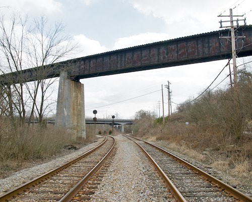
Chesapeake & Ohio to Russell, KY - CSX, Cincinnati Terminal Subdivision
Former Chesapeake & Ohio to Russell, KY
Standard gauge line opened to Cincinnati in 1889
Downtown terminal: 4th Street Station (4th Street between Smith and John)
In active use
More Information
Photographs from Downtown & Queensgate
Chesapeake & Ohio of Indiana - Indiana Eastern Railroad
Former Chesapeake & Ohio of Indiana to Cottage Grove, IN
Standard gauge line opened in stages between 1902 and 1910
Downtown terminal: 8th & McLean, then Baymiller Street Station (5th & Baymiller), then 4th Street Station (4th Street between Smith and John)
Dismantled south of Fernald in 1979, in limited use north of Fernald
More Information
Photographs from South Fairmount to Crosby Township
-
Dayton & Cincinnati (Short Line) Railroad
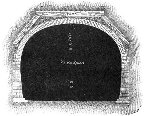
Dual standard/wide gauge railroad proposed between Cincinnati and Dayton in the mid 1850s via deep level Deer Creek Tunnel under Walnut Hills - Never completed
More Information
Photographs and Diagrams
-
Cincinnati & Fayetteville Railroad
Cincinnati & Fayetteville/Cincinnati, Fayetteville, Hillsboro & Huntington/Cincinnati, Hocking Valley & Huntington/Cincinnati, Atlantic & Columbus - Narrow gauge railroad partially constructed between Milford and Newtonsville in the 1870s
- Never completed
- More Information
-
- Cincinnati Western Railroad
Standard gauge railroad graded between Cincinnati and Indiana in the mid 1850s - Never completed
More Information - Photographs
from South Cumminsville to Colerain Township
-
Louisville & Nashville to Corbin, KY - CSX, Huntington West Division, CC Subdivision
Former Kentucky Central/Louisville & Nashville to Corbin, KY
Standard gauge line opened in the late 1850's
Downtown terminal: Central Union Depot (3rd Street & Central Avenue) or 4th Street Station (4th Street between Smith and John)
In active use
More Information
Louisville & Nashville LCL Subdivision - CSX, Louisville Division, LCL Subdivision
Former Louisville, Cincinnati & Lexington/Louisville & Nashville LCL Subdivision (Short Line)
Standard gauge line opened in 1869
Downtown terminal: Pan Handle Station (Pearl & Butler Streets)
In use
More Information
Louisville & Nashville, Wilder Main - CSX, Louisville Division, LCL Subdivision
Formerly part of the Louisville & Nashville LCL Subdivision (Short Line)
Standard gauge line opened in 1869
Downtown terminal: Pan Handle Station (Pearl & Butler Streets)
Dismantled north of former C&O line in Newport, KY
More Information
Photographs from Downtown & Newport, KY
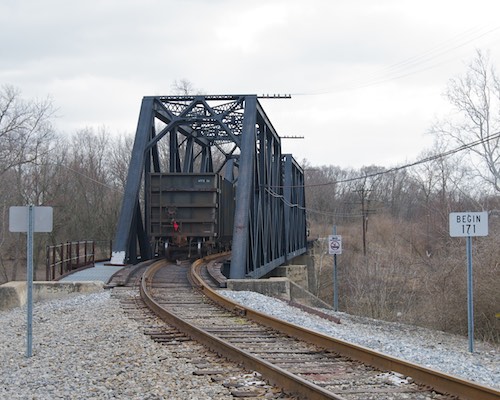
New York Central/Big Four, CIND Subdivision - Indiana & Ohio, CIND Subdivision
Former Indianapolis & Cincinnati/CCC & St. L (Big Four)/New York Central to Indiana
Standard gauge line opened to Cincinnati in 1863
Downtown terminal: Central Union Depot (3rd Street & Central Avenue)
In use except downtown terminal areas
More Information
Photographs from Downtown to Lawrenceburg
-
New York Central/Big Four to Columbus - Norfolk Southern, Dayton District, Central Division
Former CCC & St. L (Big For)/New York Central to Columbus
Standard gauge line opened in 1872
Downtown terminal: Central Union Depot (3rd Street & Central Avenue)
Line begins at Ivorydale (St. Bernard) and heads north via Sharonville, Middletown, and Dayton
In active use
More Information
Norfolk & Western to Portsmouth - Norfolk Southern, Cincinnati District, Lake Division (Peavine) - Cincinnati East Terminal Railway
Former Cincinnati & Eastern/Cincinnati, Portsmouth & Virginia/Norfolk & Western to Portsmouth, Branch to New Richmond (abandoned in 1889)
Narrow gauge (3'-0") line opened in stages between 1876 and 1882, converted to standard gauge in 1894
Downtown terminal: Court Street Station (E. Court & Reedy Streets)
In limited local use (no through traffic) east of Clare Yard, closed to all traffic west of Clare as of September 10, 2009
More Information
Main Line Photographs from Norwood to McDermott
-
- New Richmond
Branch Photographs from Newtown to New
Richmond
Norfolk & Western, Cincinnati Connecting Belt Railroad
Former Cincinnati, Portsmouth & Virginia/Norfolk & Western from Idlewild (Norwood) to Ivorydale (St. Bernard)
Standard gauge line opened in 1901
Mostly abandoned except a few connecting tracks near Ivorydale
More Information
Photographs from Evanston through Norwood
Pennsylvania Railroad/Norfolk & Western to Ft. Wayne, IN - Norfolk Southern, Newcastle District
Former Eaton & Hamilton/Cincinnati, Richmond & Chicago/Cincinnati, Hamilton & Dayton/Pittsburgh, Cincinnati & St. Louis/Pennsylvania/Norfolk & Western Railroad to Ft. Wayne, IN
Standard gauge line opened in 1853 between New Miami and Richmond Indiana, and in 1888 between Hamilton and Rendcomb Junction
Downtown terminal: Pan Handle Station (Pearl & Butler Streets)
In active use
More Information
Pennsylvania Railroad Richmond Division - Indiana & Ohio, Oasis Subdivision
Former Cincinnati & Richmond/Pennsylvania Railroad - Richmond Division from Valley (Fairfax) to Mill (Evendale)
Standard gauge line opened in 1888
Downtown terminal: Pan Handle Station (Pearl & Butler Streets)
In limited use
More Information
Photographs from Rendcomb Jct. to Pleasant Ridge
Pennsylvania Railroad/Cincinnati, Lebanon & Northern - Indiana & Ohio, Blue Ash and Mason Subdivisions
Former Cincinnati, Lebanon & Xenia/Miami Valley Narrow Gauge Railway/Toledo, Delphos, and Burlington/Cincinnati Northern/Cincinnati, Lebanon & Northern/Pennsylvania Railroad to Lebanon and Dayton
Narrow gauge (3'-0") line opened in 1881, converted to standard gauge in 1894
Downtown terminal: Court Street Station (E. Court & Reedy Streets)
Mostly abandoned except limited local use from Norwood to Fields Ertel, and Mason to Lebanon
More Information
Photographs from Downtown to Lebanon
Pennsylvania Railroad/Little Miami Railroad - Indiana & Ohio, Oasis Subdivision
Former Little Miami/Pan Handle/Pennsylvania Railroad to Springfield
Standard gauge line opened in stages from 1841 to 1847.
Downtown terminal: Pan Handle Station (Pearl & Butler Streets)
Mostly abandoned except limited local use from Fairfax to downtown
More Information
Photographs from downtown Cincinnati through Xenia
Pennsylvania Railroad, Waterfront Belt Line
Former belt line built to connect the Little Miami and Indianapolis & Cincinnati along the Cincinnati waterfront
Standard gauge line opened in 1864
Abandoned in 1986 and dismantled west of Broadway Street in 2000
More Information
Photographs from Queensgate to Sawyer Point
Pennsylvania Railroad, Zanesville Branch
Former Cincinnati & Muskingum Valley Railroad from Morrow to Zanesville
Standard gauge line opened between 1853 and 1856
Downtown terminal: Pan Handle Station (Pearl & Butler Streets)
Dismantled between Morrow and Wilmington, in use east of Wilmington
More Information
Photographs from Morrow to Wilmington
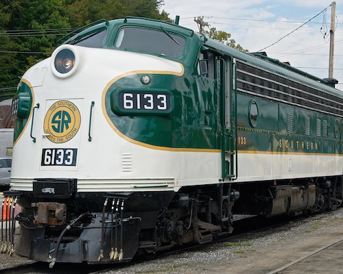
Southern Railway - Norfolk Southern, Central Division, Cincinnati New Orleans & Texas Pacific 1st District
Cincinnati Southern Railway/CNO&TP
Broad gauge (5'-0") line opened to Chattanooga in 1880, converted to standard gauge in 1886
Downtown terminal: Central Union Depot (3rd Street & Central Avenue)
In active use
More Information
Photographs from Queensgate to Ludlow, KY
New York Central/Big Four, Whitewater Division - Indiana & Ohio, Brookville Subdivision
Former CCC & St. L (Big Four)/New York Central to New Castle, Indiana
Standard gauge line opened in 1862
Downtown terminal: Central Union Depot (3rd Street & Central Avenue)
In limited local use, all track restricted to 10 mph or less
More Information
Photographs from Valley Junction to Laurel Feeder Dam
Other Transit Items
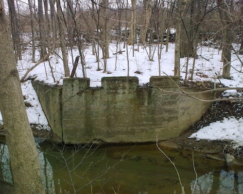
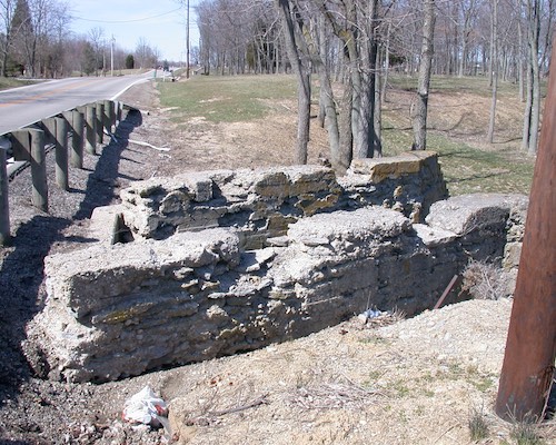
Miami & Erie Canal, Warren County Canal, and the Cincinnati Subway
More Information
Photographs from Downtown Cincinnati to Troy
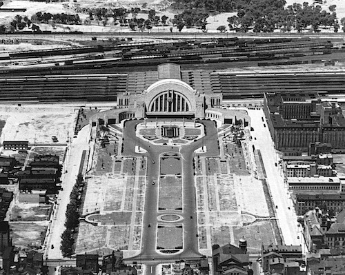
- Cincinnati Union Terminal
Cincinnati Machine Complex
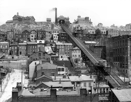
- Inclines
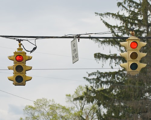
- Street Lights, Poles, & Signals
- Miscellaneous
Roads & Viaducts
Links to Other Transportation Sites
Cincinnati/Ohio Transportation Related Site
Abandoned "...a personal project aimed to document and record the abandoned and neglected buildings through text and photographs."
American Memory: Railroad Maps of Ohio High-quality scans of old railroad maps from the 19th century at the Library of Congress website.
Cincinnati Dinner Train "The Cincinnati Dinner Train operates every Saturday throughout the year. Some of its features include dining for up to 108 people on two vintage dining cars. Also featured is the Queen City Tavern car with a full service cash bar, music, and two open side doors for viewing as we travel the city of Cincinnati."
Cincinnati Railroad Club "The club is a not-for-profit educational organization with an active membership of over 300. The members have a serious interest in railroads and Cincinnati area history."
Cincinnati-Transit.net A large and very thorough site "Dedicated to the history of and future plans for the city's transportation infrastructure."
Cincinnati Transit Historical Association "The CTHA is a non-profit organization dedicated to preserving transit information, photographs, ephemera and memorabilia relating primarily to the Ohio, Kentucky and Indiana region."
Cincinnati Triple Steam a volunteer effort to preserve, share, and show off the Water Works' original 1,400 ton, 104 feet high triple expansion crank and flywheel water pumping steam engines.
Dave's Electric Railroads Numerous historical photos of streetcars and trolley buses from throughout the country.
Cincinnati Street Railway
Cincinnati & Lake Erie
Ohio Electric Includes CG&P, CM&B, and the C&LE predecessor Cincinnati, Hamilton & Dayton.
Dayton Trolley Transit History, maps, and pictures of Dayton's transit, with emphasis on the current trolleybus system.
David Rumsey Map Collection High quality scans of many old maps of the Cincinnati area.
Duck Creek Road "Pre-Interstate Urban Archaeology, Duck Creek Road Cincinnati and Norwood, Ohio." This site has a ton of information and pictures of this road that has been mostly obliterated by I-71.
Grasshopper Railroad "The Story of the Waynesville, Port William and Jeffersonville Railroad."
Historic Aerials "Provides free online access to historic and current aerial photography."
History in Your Own Backyard "The purpose of this website is to let people know about the hidden jewels in their own backyards, before they disappear forever." Focusing primarily on Indiana, Ohio, and Kentucky.
Kings Mills Trolley Station A description of Daniel Bingamon's home, which used to be the town's IR&T Rapid Railway station.
Search for "Cincinnati" as the title at the bottom of the page, do not fill out the geographic place name. The maps are listed by number. See here for a list of which maps show what neighborhoods.
MyTopo: Historical Topographic Maps Scans of USGS maps from the early part of the 20th century.
My Road Photos "This webpage features photos (and videos since 2008) of roads, transportation features, and city skylines that I or my cohorts have taken over the years."
NOAA Historical Map and Chart Project This site has very detailed topographic maps of Cincinnati from 1912.
The Railroads of Cincinnati Information and maps of Cincinnati's current railroads.
Rails and Trails A neat site with old USGS maps of Cincinnati and elsewhere "devoted to transportation history and the conversion of abandoned roadbeds into rail-trails"
Tom's North American Trolley Bus Pictures "A non-profit entity dedicated to educating all who have an interest on the history of trolleybuses in North America.
University of Cincinnati Digital Resource Commons "An initiative of OhioLINK and its member libraries. The DRC is a service that collects, preserves, and distributes digital material."
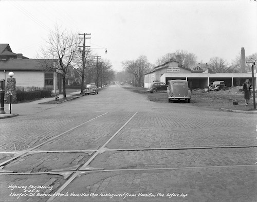
See the Street Construction and Improvements Collection for photographs of street rehabilitation.
- Other Transportation Sites
- Chicago "L".org "The internet's largest resource for information on Chicago's rapid transit system."
- Forgotten-NY Enormous site about everything from NYC subways and trains to lamp posts and alleys.
- North Shore Line Very extensive site on the Chicago North Shore & Milwaukee Railroad.
- The Transit Stations of Arthur Gerber Information and pictures of this architect's designs for North Shore Line stations. Site is no longer online, link goes to the Internet Archive Wayback Machine.
- This site includes a drawing by yours truly.
- My Other Site
Acknowledgments
Many thanks to: Jim Barrie, Bruce Bernhard, Daniel Bingamon, Jack Bonert, Brandon Brooks, Sherman Cahal, Earl Clark, Jr., Steve Cutter, Robert Deffinger, Mike Edwards, Tim Edwards, Jeff Evans, Don Faris, David Frey, David H. Fritze, Melvin (M.L.) Garrison, Satolli Glassmeyer, Andy Harman, Jim Hetzer, Tim Hoeflich, Rick Johnson, Robert Jonas, Erik (J.E.) Landrum, Dennis Larrick, Phil Lind, Lou Lockwood, Patrick McDermott, Jake Mecklenborg, Kyle Montgomery, Allen Morrison, Tom Morrow, Bill Myers, Rick Myers, Lee Nordloh, Mike Oestreich, Bill Oeters, Tom Phillips, Mike Pillman, David Pommert, Vicki Rafferty, Corwin Sapp, Cliff Scholes, Dick Segerer, Allen Singer, Jeff Smith, Michael G. Smith, Stephen Titchenal, Casey Tompkins, Bill Van Doren, David Wallace, Casey Walter, Anthony Wood, Jeff Wood, and anyone else I forgot to mention, for providing helpful information and other contributions to this site.
References
This web site was made on a Mac with SeaMonkey. The map was made from GIS data with QGIS, PowerCADD, and Affinity Photo. The map viewing software is OpenSeadragon. Photo galleries were made with Capture One Pro and jAlbum.
© 2001-2026 Jeffrey B. Jakucyk unless otherwise noted