PRR/CL&N - Pennsylvania Railroad/Cincinnati, Lebanon & Northern - Indiana & Ohio, Blue Ash and Mason Subdivisions
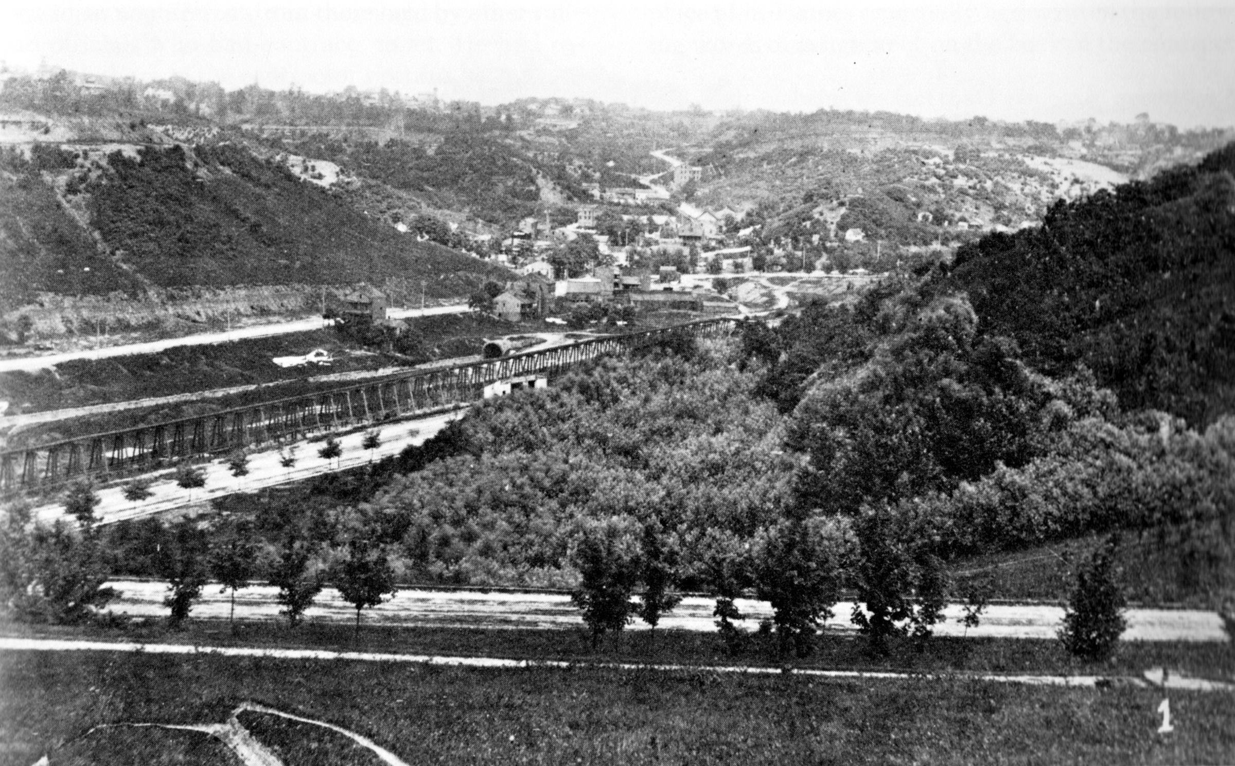
Historic photo of the Deer Creek Valley in about 1880, looking north across Elsinore Street. Gilbert Avenue and the CL&N are climbing to Walnut Hills from the center left up to the right. Reading Road, then known as Hunt Street, is along the bottom of Mt. Auburn and can be seen snaking up towards Avondale at the top center. This is also the only known photo of the Deer Creek Tunnel's south portal, which is easily visible just above the CL&N trestle. Today, that's right about where the entrance ramp from northbound Reading Road merges with I-71. Elsinore Street in the foreground only exists as a stair/sidewalk in the park today. From "Narrow Gauge in Ohio" by John W. Hauck


From "Narrow Gauge in Ohio" by John W. Hauck