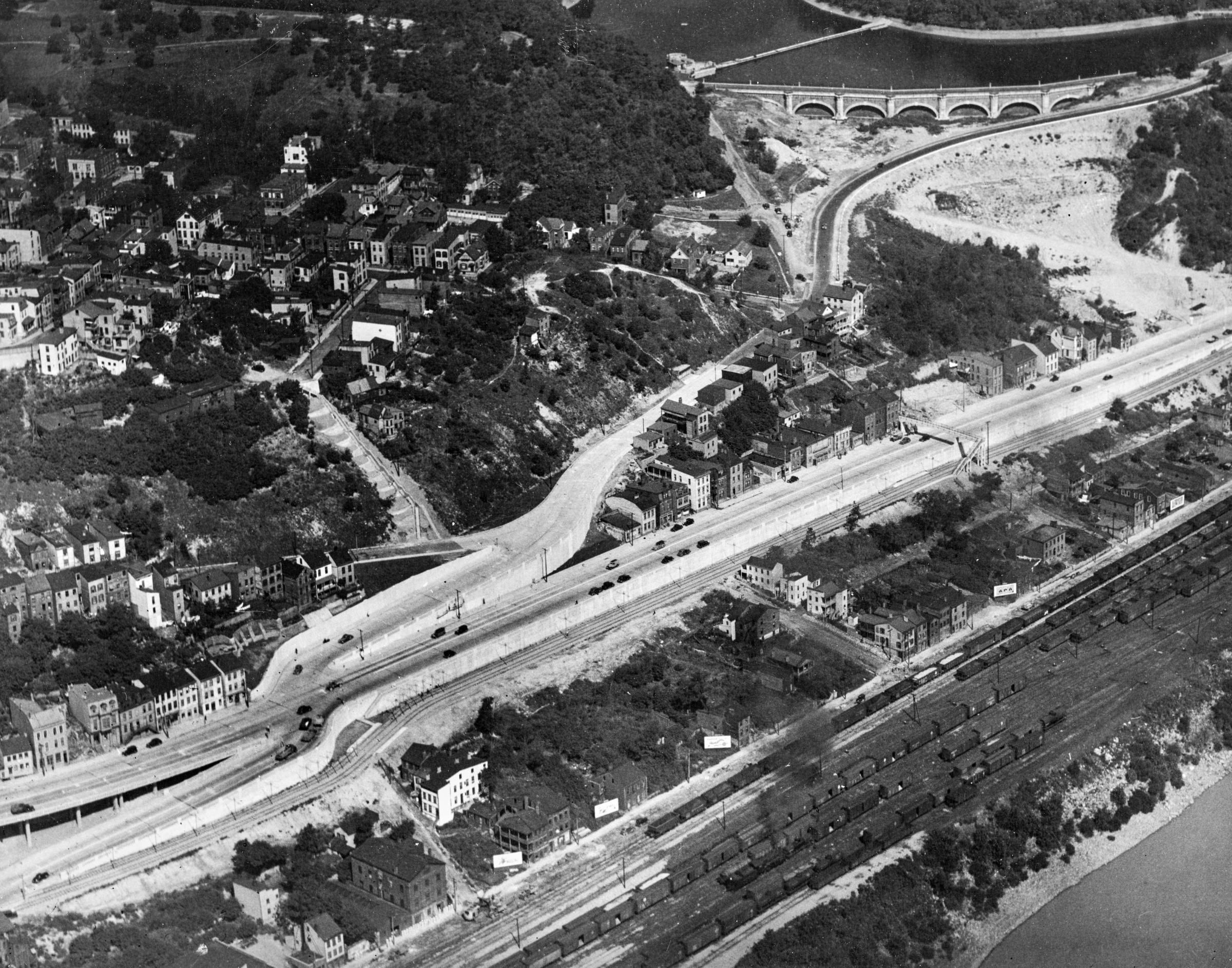
Historic aerial of Mt. Adams and Columbia Parkway shortly after completion of the parkway in the late 1930s or early 1940s, looking northeast. Note the streetcar tracks on their private right-of-way next to Columbia Parkway, the old intersection of Martin Drive, and the extensive Parson/Washington/Fulton yards of the Pennsylvania/Little Miami Railroad at the bottom right. From the University of Cincinnati Library Digital Resource Commons, Street Construction and Improvements collection.